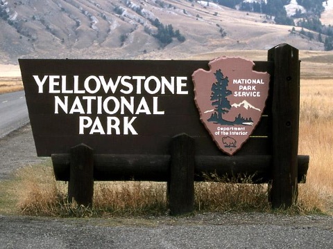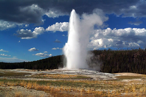
Yellowstone is one the largest National Parks and there was so much information about the park that two posts were needed to cover all the information. In Part One, I discussed the history of the park, general visitor information for planning a visit and a list of things to see and do. In Part Two, I will discuss the wildlife found within Yellowstone, such as the bears that made the park famous and the herds of elk that migrate through the park seasonally. I will also discuss the 1995 re-introduction of the wolves that was so important to balance the ecosystem of the park. Finally, I will discuss the devastating 1988 wildfire that impacted the animals and plants in the park and set the precedence for future National Park firefighting policies. Let’s start with some information and tips about safely viewing the wildlife in Yellowstone.
Information about safely viewing wildlife in Yellowstone
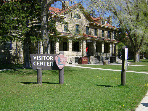
The animals that live in Yellowstone can be unpredictable and potentially dangerous. Upon arriving in the park, I would suggest stopping in the Visitor Center for more information about official rules and regulations concerning wildlife. Here are some basic rules:
- Always use designated road pullouts when viewing wildlife, follow the posted speed limits and use caution when driving. DO NOT STOP IN THE ROAD!
- Keep a safe distance from all wildlife; especially do not approach bears, wolves, bison or elk. It is illegal to willfully approach wildlife and remain within any distance that disturbs the animal.
- Use binoculars for viewing wildlife at the safe distance and avoid disturbing them, be sensitive to their natural behavior and environment.
- Be especially cautious of a female animal and her young; do not get between a mother and her babies.
- Always store food safely in the car, cabin or campsite. Use bear safe containers when available. Bears can cause severe damage to personal property so please be cautious and be safe with food storage.
Yellowstone animals can be seen at any time during the day but in general the best time for wildlife viewing is in the early morning or in the evening when there are less people. Listed below are two areas within Yellowstone National Park where wildlife viewing is highly recommended:

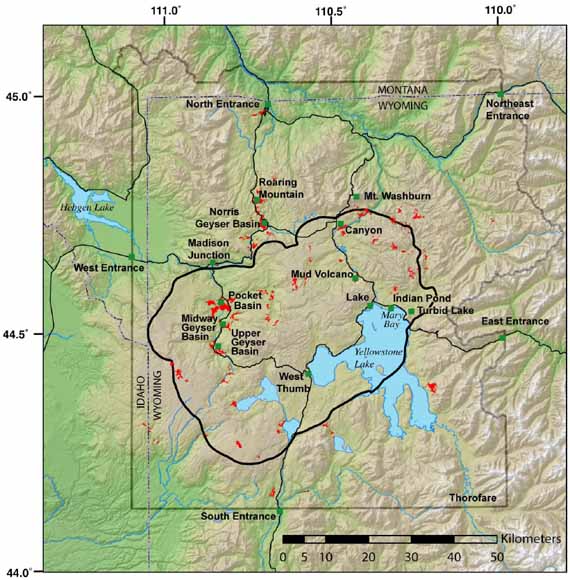
Hayden Valley –
Hayden Valley is located near Canyon Village at the center of the park. The valley is named for Ferdinand Hayden who came to Yellowstone in 1891 to do a geological survey of the area. The valley is approximately 7 miles long from north to south and 7 miles wide from east to west, an area that covers approximately 50 square miles. Hayden Valley is known as an outstanding wildlife habitat and is frequented by bison, elk, bear and coyote as well as smaller mammals and a variety of birds. The valley is closed to hiking trails that cross the valley as a means to protect and prevent any disturbance to the wildlife or their natural environment, there is no fishing allowed in the river, streams or pond within Hayden Valley. There are two trails accessible for hikers that follow the edge of the valley, the Hayden Valley Trail on the east side and Mary Mountain Trail on the north side. Hayden Valley is an excellent place for wildlife viewing especially in the early morning as the sun rises or in the evening before the sun sets because that is the best time to see the wildlife in this area of Yellowstone.
Lamar Valley –
Lamar Valley is a little more remote then Hayden Valley and it is located not far from the Tower/Roosevelt Ranger Station near the northeast entrance to the park. Lamar Valley is also a great place for wildlife viewing, especially in the early morning hours or at twilight. In the valley herds of bison and elk are most often seen, the area also has the highest concentration of grizzly bears within the park and it is the best place to see packs of wolves. When visiting the Lamar Valley be sure to bring a pair of binoculars to see the wildlife at a safe distance. Also, the valley is known for excellent trout fishing in the Lamar River, so maybe bring a fishing pole too!
The WildLife in Yellowstone National Park
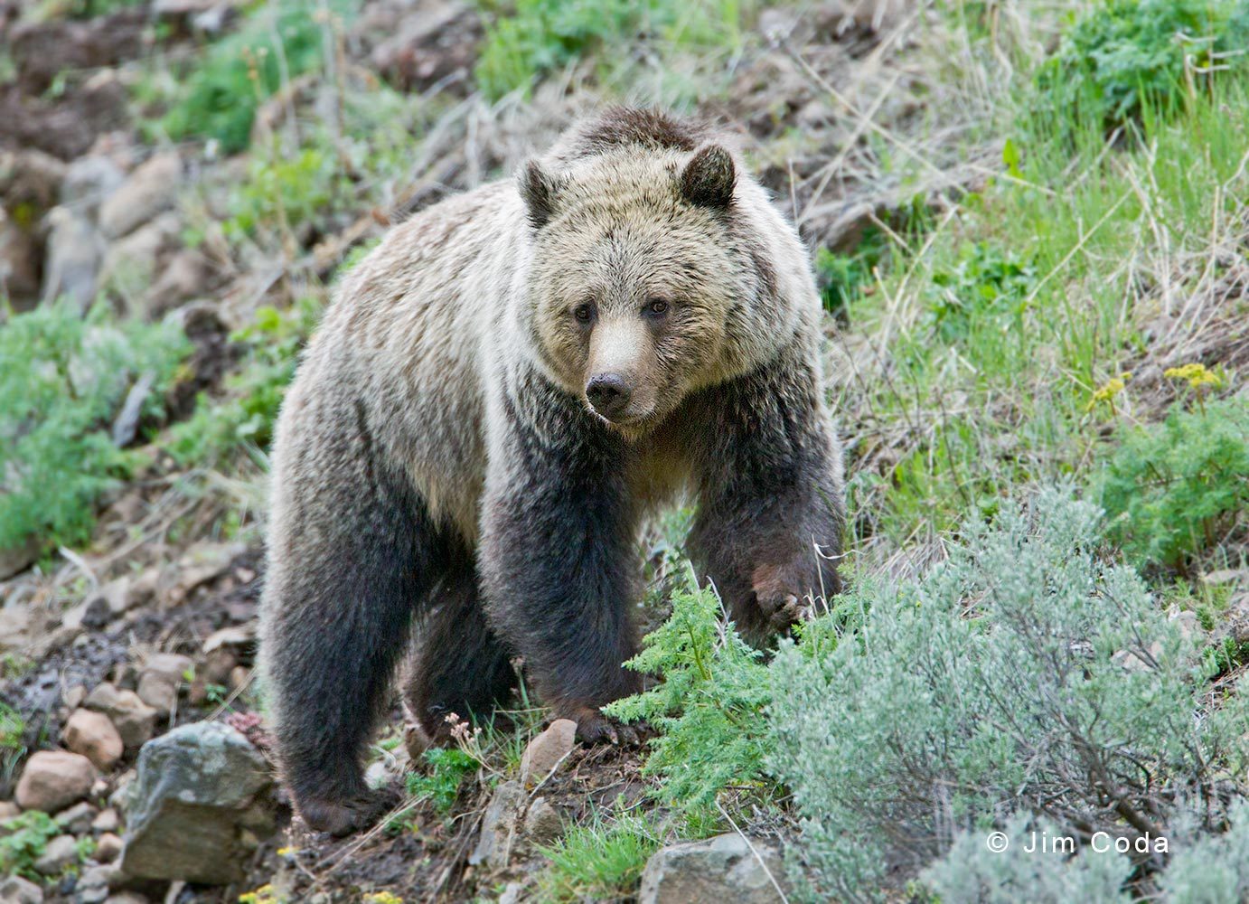
Grizzly Bear and Black Bear –
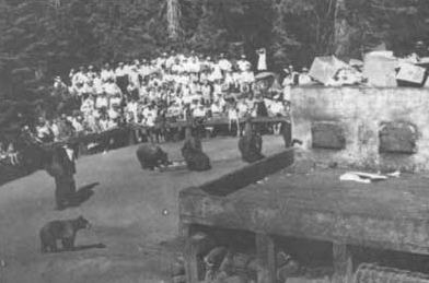
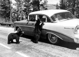
Since Yellowstone first became a National Park in 1872 visitors have been interested in the wildlife of the park, especially the bears. The grizzly bear (ursus arctos horribilis) and black bear (ursus americanus) soon became as much a tourist attraction as the geysers, lakes, rivers and mountains of the park; it is one of the only places in the United States where the two bears coexist in relative harmony. By 1889, visitors started to gather behind the hotels at night to watch the bears feeding from the garbage dumps; sometimes the bears were even hand-feed until that practice was prohibited in 1902.
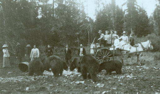
By 1910, the bears became less cautious and fearful of human contact and could be seen during the daytime along the park roads or in populated areas of the park searching for more human food. Unfortunately this situation started to lead to human injury inflicted by the bears and in 1916 the first human fatality caused by a bear was confirmed. In 1931, the National Park Service began to keep detailed records of the bear activity within the park involving human injuries, property damage and incidences when the bear’s actions needed to be controlled. Throughout the years the situation continued to escalate and by 1969 the annual report recorded 48 human injuries and over 100 cases of property damage.
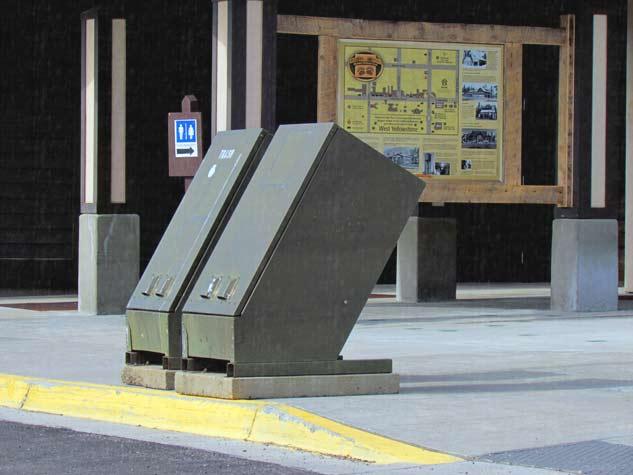
In 1970, Yellowstone began to implement a new bear management program to eliminate the bear’s dependence on human food which cause the animals to revert to a completely natural diet. New restrictions were implemented immediately and strictly enforced; the garbage dumps were permanently closed or entirely removed from the park boundaries. The feeding of bears was prohibited and new bear-proof containers were distributed throughout the park as well as notices posted regarding proper food storage and disposal of garbage. Bears frequenting popular areas where visitors are present were tagged, removed and relocated far away to the more remote backcountry areas of the park or sadly killed if it was a bear that was a repeat offender. In 1975, the population of bears had decreased significally and the grizzly bear was put on the threatened list under the Endangered Species Act. By 2000, studies showed that there was a severe reduction in personal injury to visitors caused by bears, only 1 recorded injury, and a dramatic decrease in property damage to only 14 were reported. Unfortunately in 2011 the seventh bear-related death in the park occurred.
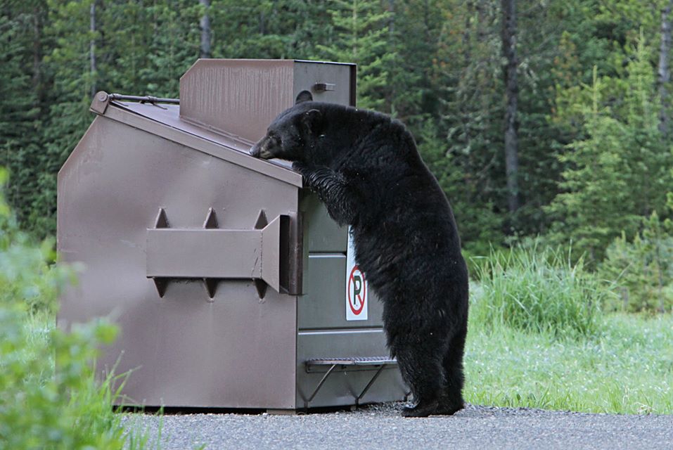
So, the bears still remain within Yellowstone National Park and park official continue to follow a program to educate the public on the dangers of close contact with bears and the need for proper food storage and trash disposal. The grizzly bears are still a presence in Yellowstone but only in the remote areas of the park such as the Hayden and Lamar valleys, there are only approximately 150 grizzly bears within the park boundaries. The black bear are relatively common in Yellowstone and can be seen more frequently than the grizzly bear throughout the park; the current population is estimated between 500-600 black bears.
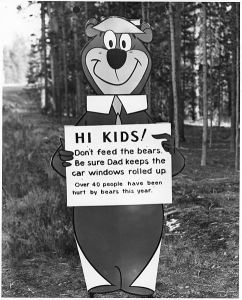
Personal Note: As a baby-boomer child, I grew up with the Sunday morning cartoons and one of my favorites was 1961 “The Yogi Bear Show” created by Hanna-Barbera. (Yogi actually made his cartoon debut in 1958 as a supporting character on “The Huckleberry Hound Show”) The plot of most of the cartoons was Yogi and Boo-boo Bear trying to steal the picnic baskets from the campers visiting the fictional Jellystone Park. So, when my family was on a road trip in the early 1970s we made a stop in Yellowstone and I was most anxious to see the bears. I was not disappointed when a mother and her cubs stopped traffic on one of the roads in the park; luckily we have some wonderful home-movies of our visit. Many years later, after the more restrictive bear regulations were fully in effect, I visited Yellowstone with my young son and I don’t remember seeing any bears during our trip but we did see bison, elk and even a coyote.

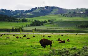
Bison –
For centuries now, the bison have roamed the North American continent, long ago there were reportedly between 30 and 60 million. The Native Americans hunted the bison and used every part of the animal, such as the bison meat for food (the tongue was said to be the most delicious and prized part of the bison to eat), the bison hide was used for clothing, tepee covers, and winter blankets, the bison bones were used for spear handles, knives and needles, the beard and tail of the bison were used for clothing and tepee decorations, brushes, the bladder of the bison was used for pouches and medicine bags and the horns were used for headdress decorations and drinking cups.
Special Note: When the French fur trappers came to this area of the United States, the bison population on the Great Plaines was still very large and they called the bison by another name, les boeufs (meaning oxen), the early settlers called the animal buffalo, a variation on the French name. The names of bison and buffalo are used interchangeably for the same animal. The American bison only lives in North American (bison bison), the other two buffalo species live in Africa and Asia. The African buffalo (syncerus caffe) sometimes known as the Cape buffalo can be found throughout Africa. The Asian buffalo (bubalus arnee) sometimes known as the Water Buffalo can be found in parts of India and Southeast Asia.
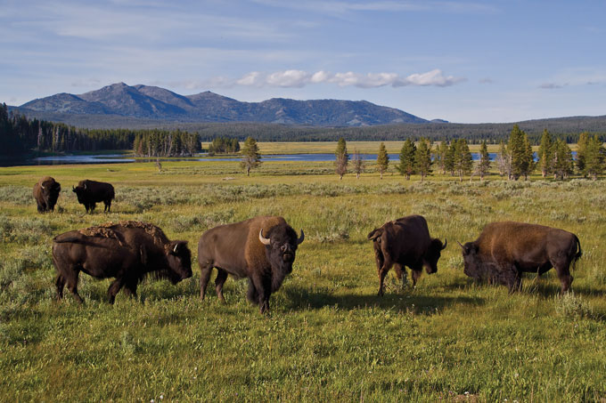
Eventually the bison were hunted almost to the point of extinction, in 1902 there were only 50 bison in Yellowstone and currently the number ranges from 4,000 to almost 5,000 depending on weather condition and food supplies. In 2008 the bison population had dropped to less than 3,000 due to a very harsh winter and a very controversial slaughter of many hundreds of bison due to brucellosis (an infectious disease caused by bacteria, most commonly found in cattle and sheep but can be transferred to humans that eat contaminated meat or animal products). It was believed the possibly infected bison were killed when they wandered outside the boundaries of Yellowstone in an effort to protect the cattle of the private ranches in the vicinity from the perceived threat. Since then, the APHIS (Animal and Plant Health Inspection Service) have recommended vaccination to eliminated brucellosis from the bison and elk herds throughout Yellowstone.
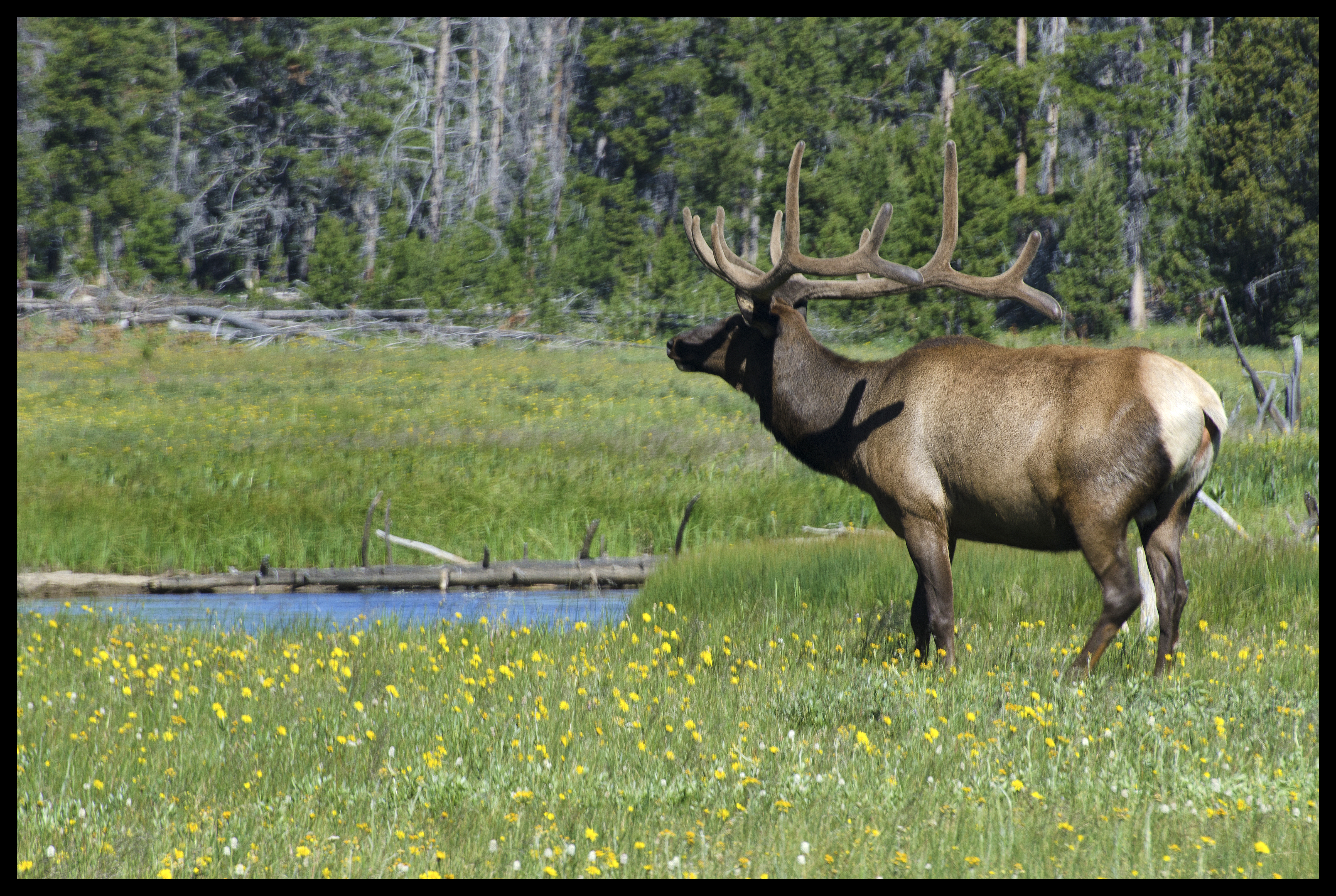
Elk –
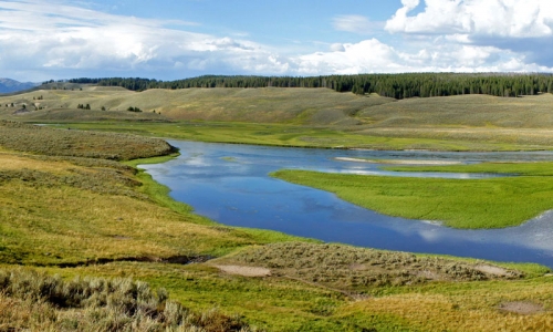
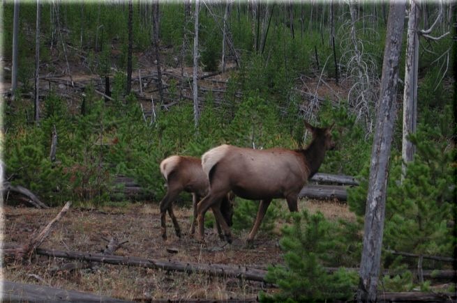
The Native Americans called the elk wapiti which translate to white-rumped deer. The North American elk (cervus canadensis) is the largest population of mammals found within Yellowstone National Park. The northern elk herds spends the summer months mostly in the Lamar and Yellowstone river valleys located in the northern section of the park. In the fall and winter months the herds migrate to the northwest area of the park near Mammoth Hot Springs eventually settling around Gardiner, Montana or just outside the northwest boundary of the park. The number of elk of the northern herds has decreased drastically from 16,000 in 1995 when the gray wolves were re-introduction back into Yellowstone to almost 5,000 in 2015.
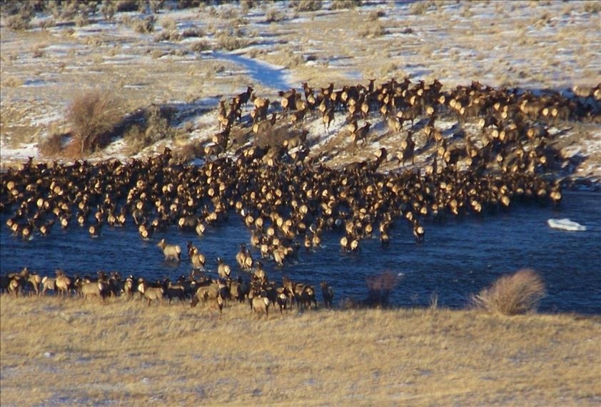
The southern elk herds spend the summer months in the area between Grant Village and the South Entrance of Yellowstone National Park. In the fall and winter months the herds migrate south out of Yellowstone through to the Grand Teton National Park and finally settle in an area known as the National Elf Refuge located in the Jackson Valley. The average winter count of the elk is approximately 7,500 each winter in the Refuge. There is also one herd that lives year-round inside Yellowstone Park in an area slightly north of Old Faithful, the Madison-Firehole elk herd is less than 100.
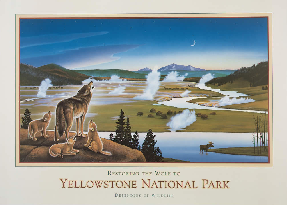
1995 Re-introduction of Wolves into Yellowstone National Park
Lamar Valley is the location where the gray wolves (canis lupus) were re-introduced to Yellowstone National Park in 1995 after an absence of almost 70 years. When the park was first created in 1872, the population of gray wolves was already starting to decline due to the increased settlement within the area. Local ranchers, cattlemen and farmers were seriously concerned when many of their horses and cattle were severely injured or killed by wolves. This very vocal group of citizens lobbied for stricter regulations and controls of these “dangerous” animals, but unfortunately Yellowstone’s national park status did not provide protection for the wolves and in fact many U.S. government predator control programs during the first part of the 20th century helped to eliminate the gray wolves, the last ones were killed in Yellowstone in 1926.
By the 1940s, several independent studies were done by park managers and scientists that indicated that the wolves actually helped to balance the wildlife in the region; an example of this was the dramatic increase in the elk population that was overgrazing the land and systematically destroying the plants and trees. Then, when the Endangered Species Act was passed in 1973 and the gray wolf was put on the list which would now allow the process of the legal reintroduction of the wolves back into Yellowstone, even with legal authorization the process was met controversy and renewed protest from the ranchers and cattlemen. Finally in January 1995, 14 wolves were captured in Jasper National Park in Canada and a few weeks later they were relocated to Yellowstone and held in pens until March when they were released into the Lamar Valley, an additional 17 wolves were released in 1996 and these were the last ones because park officials thought that natural reproduction of the wolves would be sufficient to maintain the packs.

Today, twenty years after the wolves were re-introduced to Yellowstone; there are almost 100 wolves that are divided into ten different packs that roam mostly in the northern section of the park, about 22% of the wolves have been equipped with radio collars to tract their movement. The recovery number goal that was determined by the U.S. Fish and Wildlife Service was reached in 2002 and since that time the gray wolves have been removed from the endangered species list. Unfortunately, this means that any wolves that wander outside of the boundaries of Yellowstone National Park can once again be legally shot and killed. Time will tell what the lasting effects of the re-introduction of the wolves back into Yellowstone will mean but studies are showing that one benefit is a much more balanced ecosystem with a decrease in the elk population since the wolves return.
1988 Yellowstone Wildfire
To put the Yellowstone wildfire in perspective we need to first take a look at the National Park Service fire management policy. When the NPS was first established it was believed that any fire started within a National Park should be immediately fought and extinguished as soon as possible regardless of whether the fire was started naturally by lightning or by humans. Firefighting crews were established for the purpose to fight the fires on the ground and by the 1940s additional firefighting methods included lookout towers for spotting fires, special helicopters and airplanes with water or fire retardant drop capabilities and smokejumpers (a specially trained fire crew that parachutes into an area to extinguish fires in remote locations). But over time, environmentalists began to determine that wildfires were actually beneficial to the forest ecosystems for natural tree and plant propagation. After extensive studies and reports, the National Park Service revised the fire management policy in 1972 to allow fires started naturally to burn out without assistance if there was no risk to human lives or property. They also allowed controlled burns (prescribed fires to reduce shrubs and trees) periodically set to restore balance to the ecosystems when needed in specific areas.
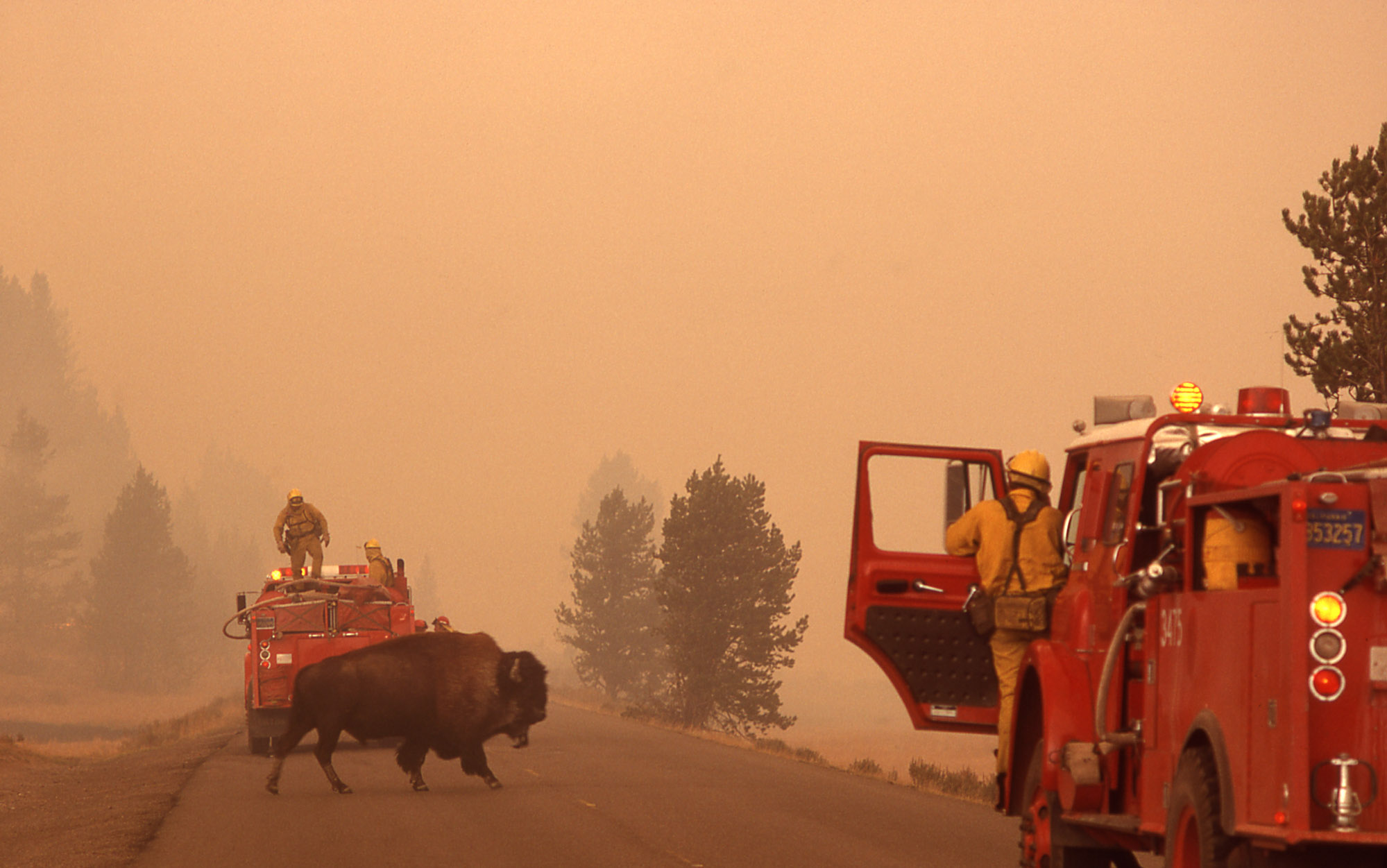
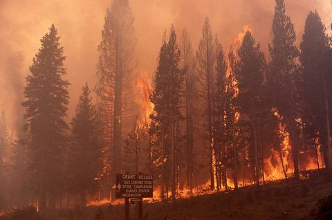
The 1988 Yellowstone wildfire was the largest one in the history of Yellowstone National Park; almost 800,000 acres in the park were affected by the wildfire. At the time Yellowstone was experiencing one of the driest summers on record and the severe drought conditions created vast areas of extremely dry grasslands and dense underbrush in the forests. From mid-June to mid-September several fires, ignited by the dry vegetation and aided by the increasingly strong winds, broke out in various areas of the park. Per the NPS policy on fire management, the fires that were caused by careless park visitors were attempted to be contained and extinguished by fire crews. The other fires that were started by lightning strikes were allowed to burn but closely watched by fire crews that intervened when the fire threatened populated areas of the park.

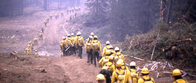
Then, as the days and weeks passed, the individual fires joined to become larger fires creating a perfect fire storm that was building to massive proportions with potential of burning almost everything in its path and threatening many historic buildings as it progress through the park. Finally near the end of July the National Park Service started a concentrate effort to control and extinguish ALL the fires that were now engulfing over 60% of the park. Over 20,000 firefighters were fighting fires in various locations throughout the park and assisted by helicopters and airplanes making water and fire retardant drops, also 4,000 U.S. military personnel were brought into Yellowstone to help with the fire control efforts.
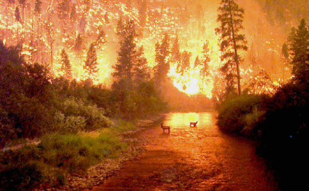
On August 20 the unthinkable happened when 150,000 acres were consumed throughout the day in a series of intense firestorms, the day would become known as “Black Saturday”. The land destroyed in that one single day exceeded the total amount of land burned by fire since the establishment of Yellowstone National Park, which is a period of 116 years. The high winds that day caused the fire to jump roads and bulldozed fire lines, burning embers blown a mile away were reported to have started new fires and ground fires raced up the forest trees creating a wall of fire over 200 feet high.
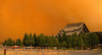
NPS staff and other land management agencies proved to be unprepared for the catastrophic situation and the decision was made to close the park to visitors on September 8 and to only allow authorized emergency crews inside the park. At the point when everything seemed to be out of control nature intervened on September 11 when cooler weather moved into the area, rain and snow at the higher elevations started to fall within the park. Finally, the fires were being stopped or suppressed allowing the fire crews to completely contain them and eventually all the fires within Yellowstone were extinguished although some areas of the park would continue to smolder in isolated spots until November 18 when the fires were officially declared out.
Controversy and public outrage had started while the fires were still raging in Yellowstone and only intensified afterwards. The media coverage of the Yellowstone fire was aimed at the mismanagement of the National Park Service and the public demanded to know why the fires had burned for so long without immediate action to extinguish them. Inaccurate reports indicated long-term health effects caused by the smoke or that the plants and forests destroyed by the fire would never return or the reported animal death count was highly inflated or that Yellowstone would never fully recover and to return to its previous condition.
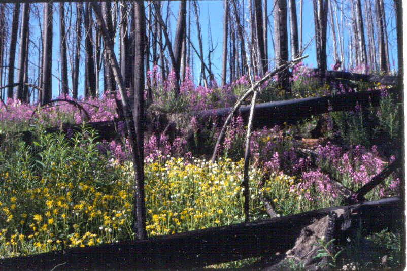
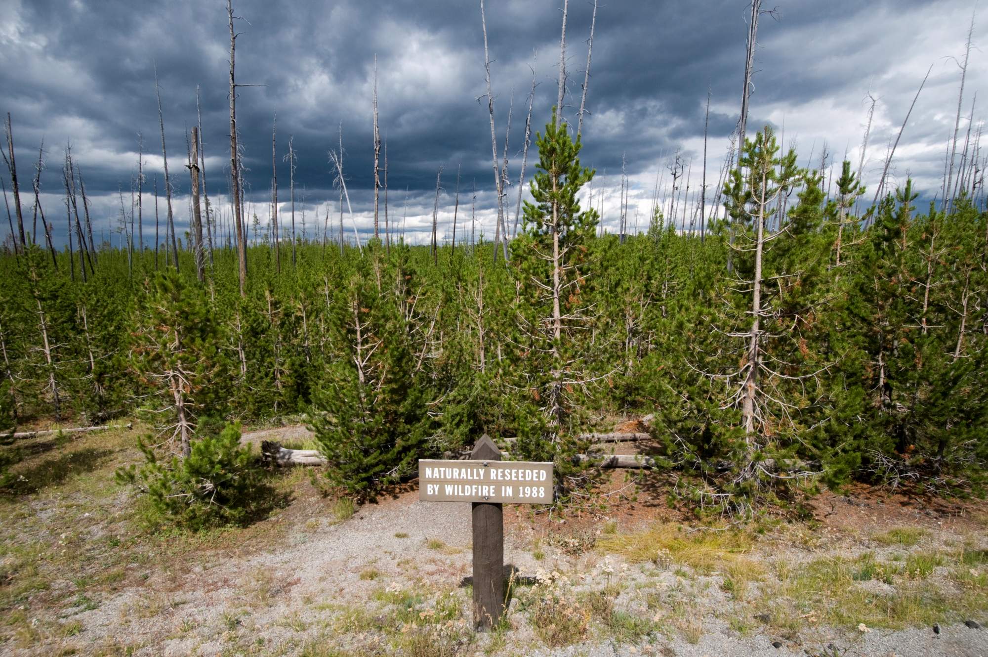
In fact, the recovery process from the fire damage is slow but it is happening. Within a few weeks plants appropriately called fireweed started growing. Most of the areas affected by the fire grow back the previous vegetation through either sprouts not damaged by the fire or a natural process of called re-seeding. An example of this process is the lodgepole pine which produces serotinous (the process of plant seeds being dispensed by an environmental stimulus rather than seed maturation) pinecones that usually remain closed and will not release seeds unless it is subjected to fire. Then, by the next spring the forest floors had an abundance of wildflowers growing and within a few years the burned areas were experiencing a rapid regeneration of their ecosystems. The Aspen tree, once rare in the park before the fire, are now experiencing a high volume of growth in areas that were once dominated by conifer trees, this can possibly be only a temporary situation until the strong conifers grow back or the Yellowstone elk eat the Aspens. About 300 large mammals died in the fire but reports show that in general the animals in Yellowstone have not been greatly affected and the animal population within the park has been maintained or has even slightly increased in certain species of mammals.
In 1992 a new fire management plan was implemented in Yellowstone National Park as a direct result of the 1988 fire. Stricter guidelines were developed for managing natural wildfires and included a larger budget and funding for fire management allotted for an increase in staff and equipment for monitoring fires. Additional revisions to the fire plan in 2004 determined the time natural wildfires could be allowed to burn by setting limits in regards to size, weather conditions and potential danger to lives or property. These changes did not affect man-made fires; the policy remained the same and it was that all man-made fires should be suppressed as quickly as possible. The overall view of the role of fire in maintaining a balanced and natural ecosystem as remained the important objective.
Special Note: Please click on the link for Part One of the two part series on Yellowstone National Park for information regarding the history of the park and how it became the first national park in the United States.
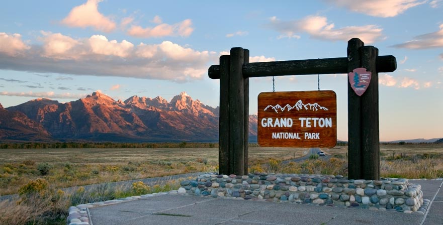
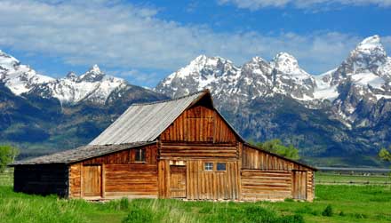
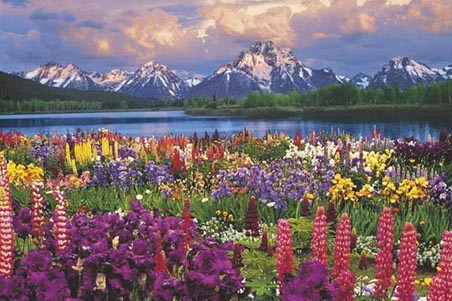
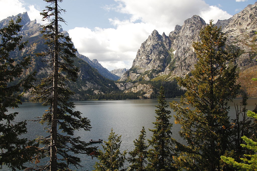
Also, be sure to check out the other Travel Post this month about nearby Grand Teton National Park, just click on the link.