The story of the California Missions started many centuries ago when Juan Cabrillo, an explorer sent by the Spanish King to explore the west coast of North America, sailed into the bay of present day San Diego in 1542. Cabrillo continued his journey and sailed along the coast of California as far as the area of present day San Francisco. But by the 17th century Spain was not the only country interested in this new land, Russia had begun establishing forts in the northern region of California to aid in their lucrative fur trapping. As a result of this potential foreign threat an expedition was commissioned by King Carlos III to protect the territory a unit of military officers and a unit of military officers and soldier would include a group of Franciscan Friars. It was thought that in order to succeed in colonizing Alta California and establishing permanent settlements they needed to convert the Native American population to Christianity so that they would remain dependent and loyal to the Spanish Crown.
The Franciscan Friars had already helped to establish Missions in Baja California and now they were given this new important task for Alta California. There would be five expeditions that would sail from Baja California, Governor Gaspar de Portola would be in charge and Father Junipero Serra (born November 24, 1713 died August 28, 1784) would be chosen to lead the group of Franciscan missionaries. Three ships departed from Baja California, the San Carlos and the San Antonio (a later supply ship, the San Jose, was lost at sea), landing in San Diego in mid-1769. Between 1769 and 1823 twenty-one missions were established along the coastal region of Alta California. Mission San Diego de Alcala was the first Mission that was established in 1769 followed by the Mission San Carlos Borromeo de Carmelo in 1770. Then, over the next 54 years more Missions were established along the El Camino Real covering the 442 miles distance between the Mission San Diego and the Mission Carmel. Several additional Missions were also built north of the Mission Carmel and the final Mission, Mission San Francisco de Solano, was added in 1823.
As settlers came into the region, they introduced many European fruits and vegetables, cattle and horses, ranching and farming techniques to the Native Americans. In 1821, Mexico gained independence from Spain but unfortunately under Mexican jurisdiction the Missions did not receive the same support as in the past. In 1833, the Act for the Secularization of the California Missions followed by the Decree of Confiscation in 1834 removed the administration of the Missions from the Catholic Franciscan Padres and given to the Mexican government. Eventually the vast properties of the Missions were divided and land grants were given to prominent Mexicans, these became the famous Ranchos of California.
In 1848, after the Mexican-American War and subsequently when California became the 31st State in 1850, the United States Army occupied many of the Missions. Some of the Missions were used as garrisons and the soldiers lived in converted barracks. Ultimately, on March 18, 1861, President Abraham Lincoln decreed that the California Missions should be returned to the Catholic Church. Throughout the following years many of the Missions were abandoned or neglected and fell into disrepair while others became local parishes of the Catholic Church that are still in use today.
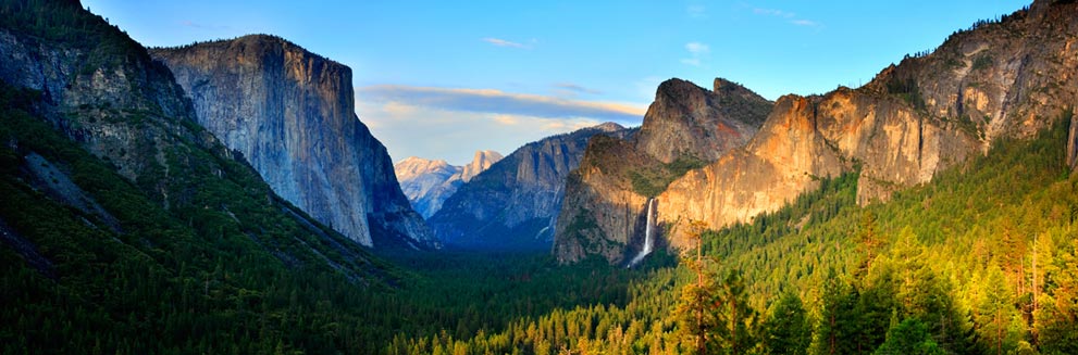
For this four part series on the California Missions, I will discuss all of 21 Missions moving from south to north and starting with the first Mission located in San Diego to the San Buenaventura Mission in Part One, then from the Santa Barbara Mission to the San Miguel Arcangel in Part Two and from San Antonio de Padua to the Santa Cruz in Part Three and then from the Santa Clara de Asis Mission to the most northern Mission San Francisco de Solano in Part Four. So, let’s get started …
Mission San Diego de Alcala
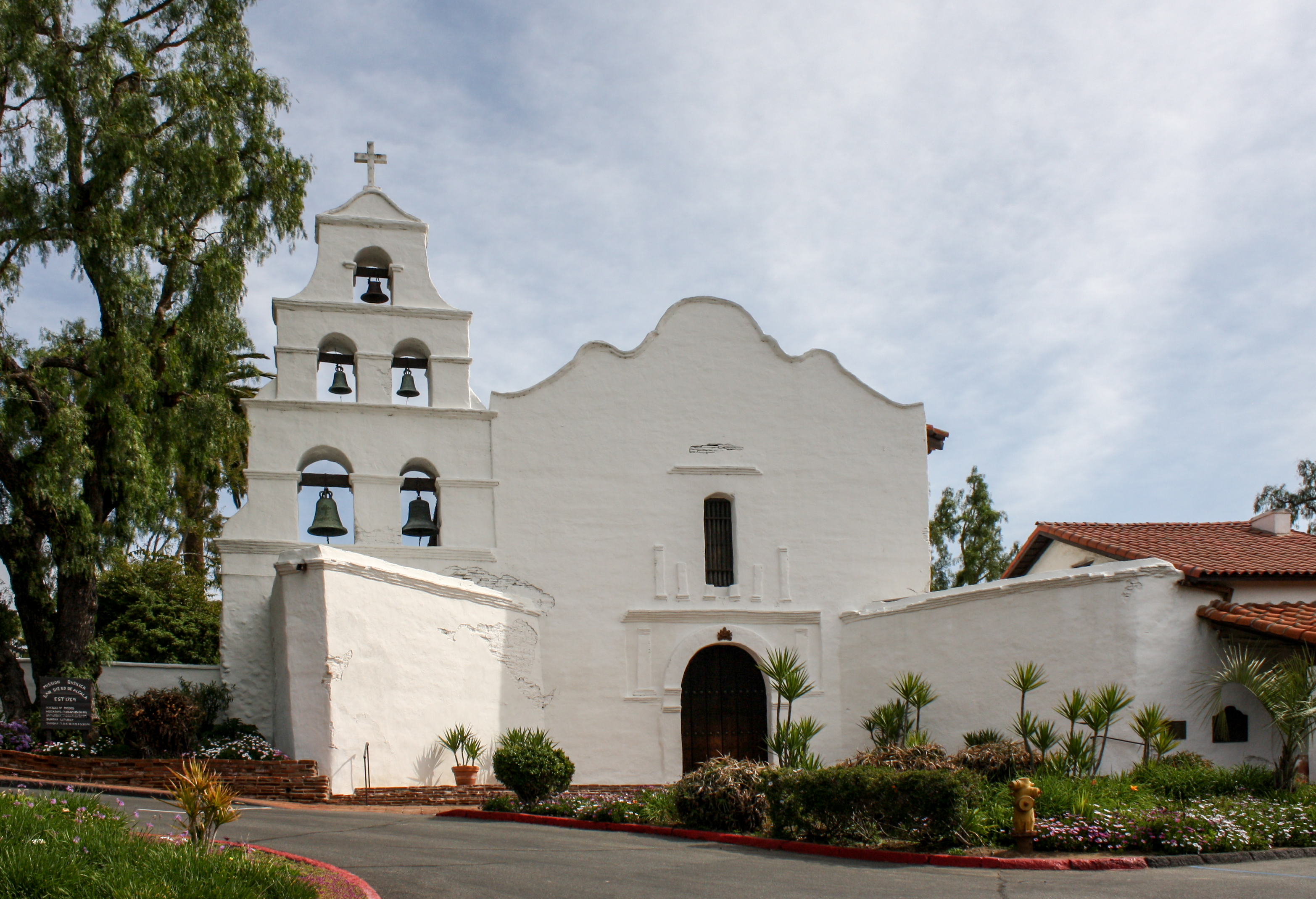
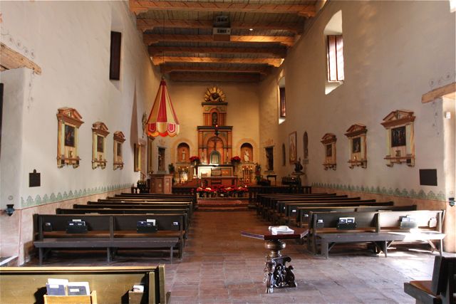
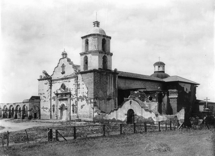
Mission San Diego de Alcala is the first of the 21 California Missions and was founded on July 16, 1769 by Juniperio Serra. Located near present day downtown San Diego, the original site was built overlooking the San Diego Bay but five years later the Mission moved east and six miles inland. The new location close to the San Diego River was better situated for growing crops and everything was progressing according to plan and by the summer of 1775 the missionaries had baptized 315 of the Native Americans.
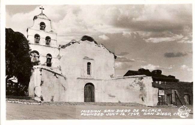
Several years passed and during that time a fraction of the Natives Americans were becoming unsettled living with the regulations and other restrictions set by the Spanish military and missionaries. On November 4, 1775 several hundred Native Americans from a nearby village revolted and stormed into the Mission burning, looting and killing several people including Father Jayme. (Historical Note: Father Jayme became California’s first Catholic Martyr and he is buried near the altar of the current Mission San Diego)
Less than a year after the incident, Father Serra returned to rebuild the Mission but this time it was fortified with 9 feet high walls built of adobe. The Mission continued the long process of reorganization and later became a successful horse and mule breeding farm that supplied the other missions. By 1797, the Mission now included 55,000 acres that was planted with corn, wheat, barley and vineyards that produced grapes for wine. The Mission had also started growing olives that produced good quality olive oil. (Historical Note: The olive tree had been introduced to California by Father Francisco de Lasuen in 1802 and cuttings from those trees would later be used to establish and supplement the successful California olive industry)
Then in 1803, after suffering from a two-year drought, the decision was made to construct a dam and an aqueduct. Supervised by the Padres and built by the Native Americans. Located about five miles east of the Mission the dam was built across the San Diego River; it was about 224 feet across, 12 feet high and 13 feet thick. The aqueduct used a gravity-flow system and was built with tiles laid onto stone foundations and was completed in 1817.
In 1821, Mexico gained independence from Spain and eventually the jurisdiction and administration of the Missions transferred from the Catholic Church to the Mexican government. As a result, in 1840, the first Bishop of California was appointed, Francisco Garcia Diego y Moreno, and the Mission became the center of the newly created Diocese of Alta California until it was eventually moved the Mission Santa Barbara in 1842. The Mexican government sold the land surrounding the San Diego Mission to Santiago Arquello in 1846.
After the Mexican-American War, the United States Army occupied the Mission turning it into a garrison and housing the soldiers in barracks until 1858. The Mission was abandoned until 1891 when it was turned into St. Anthony’s Industrial School which was run by the Sister of St. Joseph of Carondelet, the school eventually moved to Banning, Ca and the Mission was once again closed. In 1931, the Mission was rebuilt to resemble the original 1813 church and today it is used as a local parish for the Catholic Diocese of San Diego.
Mission San Luis Rey de Francia
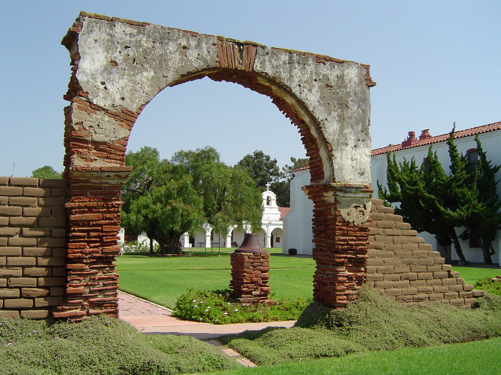
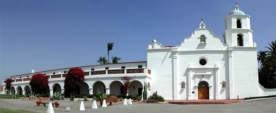
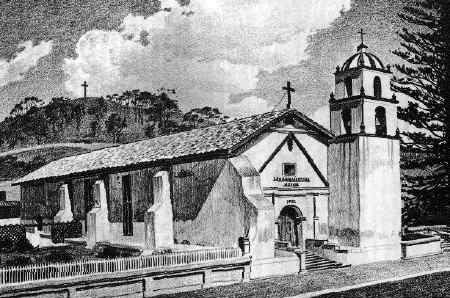
Located 5 miles east of present day city of Oceanside, the area was first visited by the Portola expedition in 1769 and became a frequent stop for camping on the El Camino Real that connected the Missions. Eventually a permanent settlement was established and the Mission San Luis Rey de Francia was founded on June 13, 1798 by Father Fermin Lasuen and was named for Saint Louis in honor of King Louis IX of France. The Mission church was built in 1811 and it is the 18th of the California Missions.
The San Luis Rey Mission was the largest, almost 950,400 acres, and one of the most prosperous of the twenty-one Missions and it had been said that it was one of the best designed due to the fact that it was one of the last Missions built. The Mission is built on a small hill and it featured a 500×500 feet quadrangle surrounded by a sunken garden and a special water system featuring a unique charcoal filters through which the water flowed into the fields.
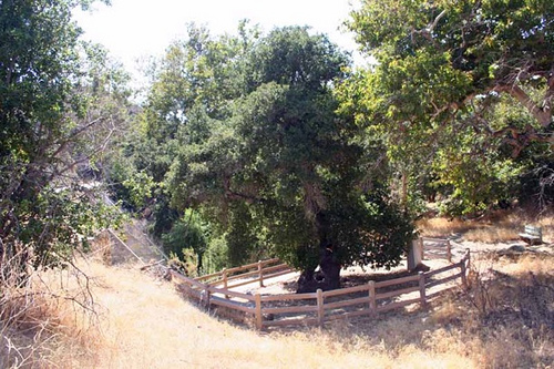
Within the courtyard of Mission San Luis Rey is the first Peruvian Pepper Tree (schinus molle) planted in California, today the tree can be seen beautifully framed by an arch. Legend has it that the seeds of the pepper tree came from a ship’s captain that had visited the Mission as a guest in 1825 and to repay the padres kindness during his visit he gifted them a handful of pepper tree seeds. The pepper tree is known for its fragrant leaves, knotted trunk and clusters of small pink berries that resemble peppercorns, hence the name of the tree. Subsequently, peppers trees were planted at the other Missions and were valued for the shade they provided and the tolerance to the semiarid conditions of California. Much later, the pepper tree proved to be so popular that after California became a state in 1850, the tree was renamed the California Pepper Tree.
After the secularization of the Missions in 1834, the Mission San Luis Rey was abandoned and after many years it fell into disrepair. Then in 1895 Father Joseph O’Keefe was put in charge of restoring the Mission and the work was completed in 1905. A Catholic seminary was opened at the Mission in 1950 but as enrollment significantly decreased it was finally closed in 1969. Today, the Mission San Luis Rey is an active Catholic parish of the San Diego Diocese.
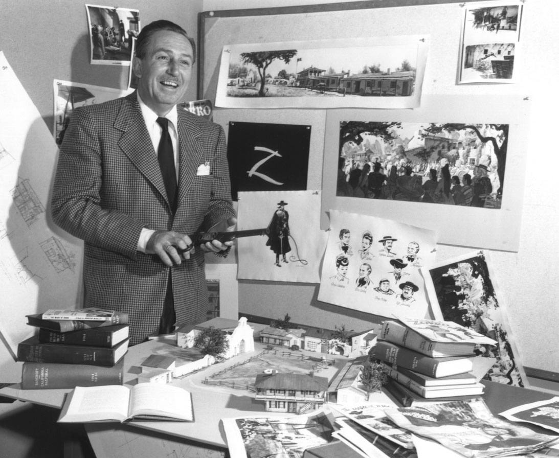
Mission Trivia: The Mission San Luis Rey was used for the filming of the 1957 Disney television series “Zorro”. The fictional character of Zorro was originally created by Johnston McCulley in the 1919 “Curse of Capistano” book. Zorro was a wealthy land owner living in California that secretly became a black masked outlaw who defended the local people from the injustice Mexican officials and he was known for his cunning ways of outsmarting the authorities and publicly humiliating them.

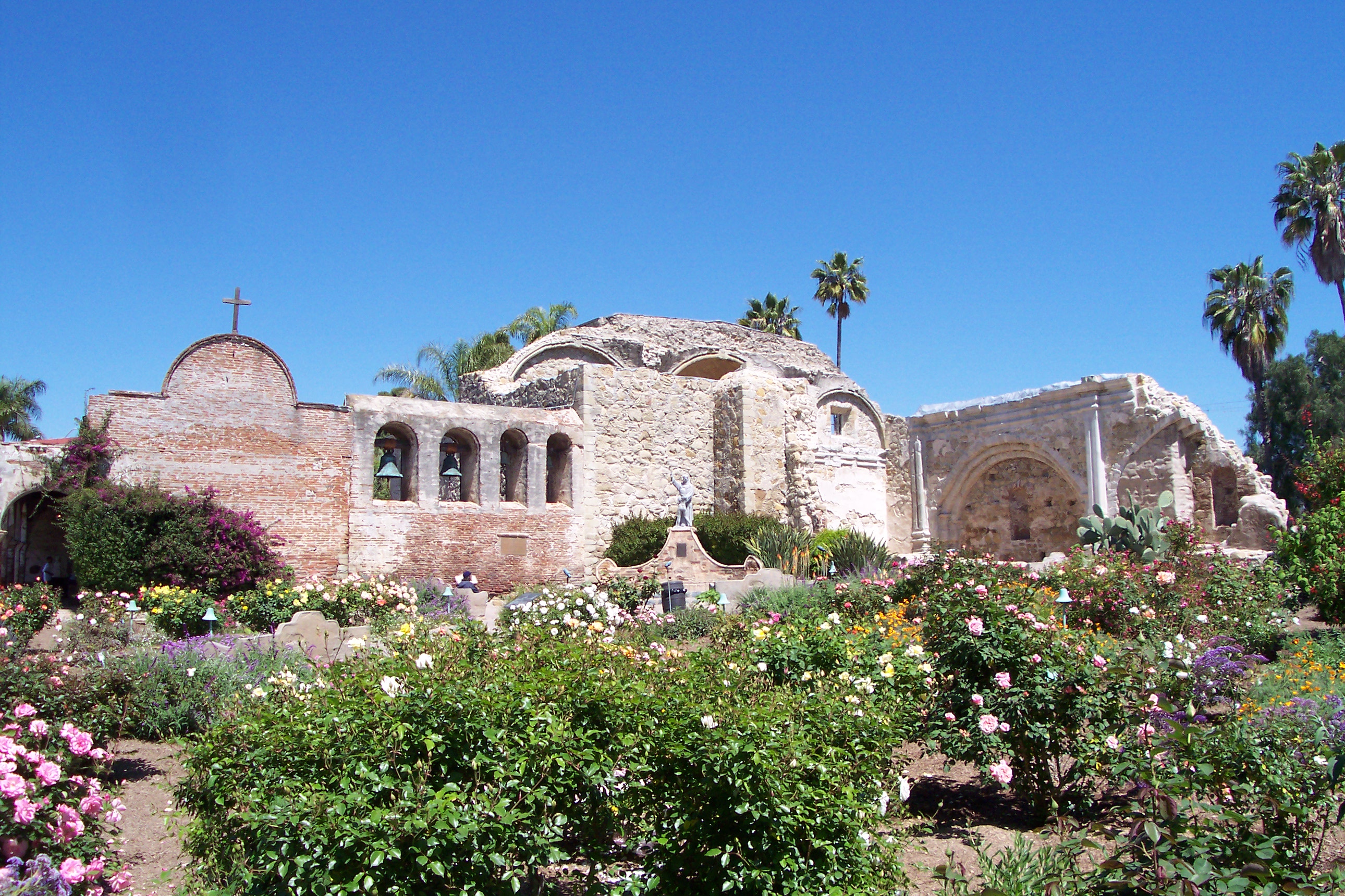
Mission San Juan Capistrano
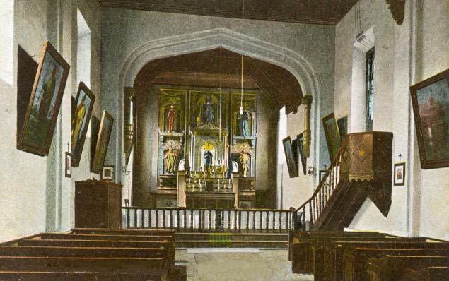
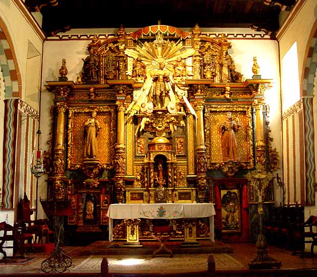
The Missions San Juan Capistrano is the seventh in the chain of the 21 California Missions and was founded by Junipero Serra, on November 1, 1776. The mission was named for the Italian Crusader, Saint John of Capistrano and was first built as a small adobe church 1778. It was later replaced by a much large church to accommodate the growing population in 1782 and has the distinction of being one of the oldest buildings still in use in California. For more detailed information, please click on the link to the previous Travel Post about Mission San Juan Capistrano.
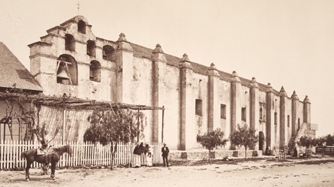
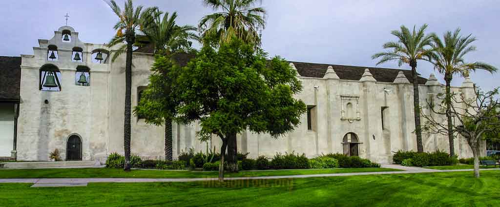
Mission San Gabriel Arcangel
Mission San Gabriel Arcangel was founded on September 8, 1771 by Father Junipero Serra; it is the 4th California Mission. The Mission was named for the Archangel Gabriel and is located in the present day city of San Gabriel. The original proposed site was located on the Rio de los Temblores (later renamed the Santa Ana River) but the Padres chose an alternate site located in a fertile area situated along the Rio Hondo River. Unfortunately, in 1776, a flash flood destroyed the Mission and the decision was made to relocate it five miles away and closer to the San Gabriel Mountains. The current Mission church was designed in a Moorish-style of architecture by the Spanish born Padre Antonio Cruzado; the design was inspired by the Cathedral of Cordoba located in Spain. The Mission features unusual elements like unique buttresses, tall narrow windows and arched shell decorations that are not seen in the other California Missions.
Then, on December 9, 1812, the devastating Wrightwood earthquake hit the area destroying the original three-bell tower on the east side of the Mission, later it was replaced by a larger six-bell structure. (Historical Note: Bells were important to the daily life of the Missions, not only did they mark the time and hours in the day but they were also rung to call the Mission residents to meals, work and religious services and they marked local births and deaths, in addition the bells signaled approaching ships or returning missionaries)
Between the years 1771 to 1834 over 25,000 baptisms were performed at the San Gabriel Mission but with the secularization of the Missions by the Mexican government, the properties were lost or given away but the Mission church continued to function as a local parish. In 1908, the Claretian Missionaries of the Sons of the Immaculate Heart of Mary Order took over responsibility of the San Gabriel Mission and began extension restoration work to repair the buildings. Much later, on October 1, 1987, the Whitter earthquake hit and the Mission sustained more damage. Today, the San Gabriel Mission remains open as an active parish of the Archdiocese of Los Angeles.
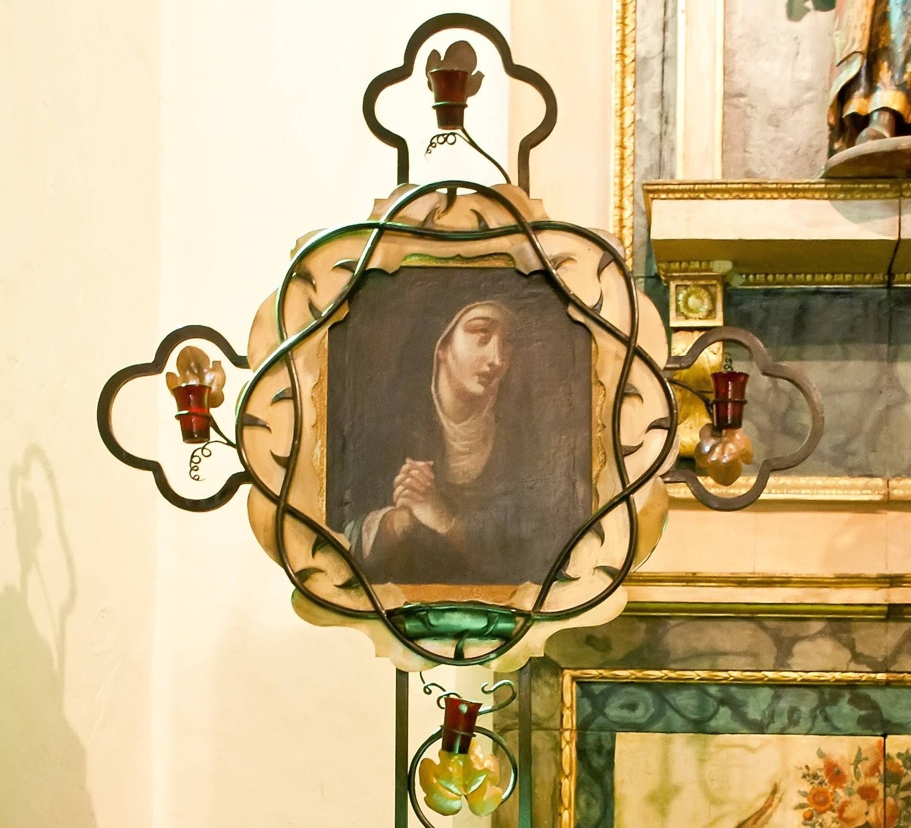
Mission Trivia: According to legend, the expedition constituting of Franciscan padres accompanied by Spanish military soldiers was confronted by a large group of hostile Native Americans, the Tongva tribe, which intended to drive the expedition members away from their land. To calm the Native Americans and demonstrate their peaceful purposes, one of the padres laid the “Our Lady of Sorrows” painting on the ground and the Native Americans were deeply moved by the painting’s beauty and a potentially volatile situation was avoided. Today, the 300 year old painting is hung at the front of the Mission San Gabriel church’s sanctuary.
Mission San Fernando Rey de Espana
Mission San Fernando Rey de Espana was founded on September 8, 1797 by Father Fermin Lasuen, it is the 17th California Mission. The Mission was named for Saint Ferdinand and also King Ferdinand of Spain, it is located in the northern section of the San Fernando Valley near the present day city of San Fernando. The area was first visited by the Portola expedition in 1769 and became a frequent stop for camping on the El Camino Real that connected the Missions; Father Juan Crespi noted in his journal that the site location in the foothills of the mountains would be an excellent location for a future Mission.
By 1819, the San Fernando Mission had 21,000 head of livestock and had a successful industry producing hides and leather for saddles, shoes and sandals as well as supplying leather strips used for building materials. In addition to the cattle, the Mission also had 8,000 sheep and 2,300 horses. The Mission padres also taught the local Native Americans their European techniques for farming and working with domesticated animals as well as working with European-styled tools.
Sadly in 1845, several years after Mexico gained their independence from Spain; the Mission buildings were sold and later used in a variety of different ways. The buildings were used by the Porter Land and Water Company as a warehouse and then later a hog farm was located on the property. In 1896, the Mission returned to the Catholic Diocese of Los Angeles and repair work was overseen by Charles Lummis. In 1923 priests from the Oblate Order came to the Mission and it returned to use as a local parish. In the 1940s, the Hearst Foundation funded a total restoration of the San Fernando Mission but sadly the 1971 Sylmar earthquake severely damaged the buildings and the extensive repairs took three years to complete.
Mission Trivia: In 1842, the first gold discovery in California was actually at a site known as the Oak of the Golden Dream in Placerita Canyon located near the Mission. Francisco Lopez, a local rancher and the brother of the foreman at the San Fernando Mission, found gold clinging to the roots of wild onion that he had dug up. This would precede the famous gold discovery of 1848 at Sutter’s Mill located near Coloma in northern California which is credited for being responsible for the California Gold Rush.

Mission San Buenaventura
Located near the present day downtown Ventura is the Mission San Buenaventura which was founded on March 31, 1782, it is named for Saint Bonaventure. The Mission San Buenaventura is the 9th California Mission and the last one to be established by Father Junipero Serra who later died in 1784. Fifty years earlier, Juan Cabrillo had landed near the present site and claimed the area for Spain. It was originally intended that the Ventura Mission would have been built ten years earlier because it was geographically located approximately halfway between the San Diego Mission and the Carmel Mission but circumstances, such as the lack of military support for protection from the Native Americans and inadequate funds for building, caused it to be established much later than planned.
The first church burned down in 1793 and a small section is still standing. The second church took 16 years to rebuild and it was completed in 1809, it is still in use as the local parish church of the Archdiocese of Los Angeles. Then, supervised under the direction of Padre Cambon and with the labor of the Chumash Native Americans, an aqueduct system was built between 1805 and 1815 using the same techniques developed from the other California Missions. The source of the water was the Ventura River located just north of the Mission and flowed into storage tanks waiting for distribution. With a great abundance of water the Mission flourished with orchards of apple, pears, peaches, pomegranate, fig and olive trees and grape vineyard. (Historical Note: The two Norfolk Pines located at the front of the Mission were planted by a ship’s captain over 100 years ago in the hopes that a forest would eventually grow to provide wood for ship building)
After the Mexican government’s secularization of the California Missions in 1834, the San Buenaventura Mission was later obtained illegally by Don Jose Arnaz. Later, during the Mexican-American War of 1846-47, a large U.S. Army battalion led by Major John Fremont encountered a small band of hostile locals near the Mission but the battalion managed to easily defeat them. Then, after California became a state in 1850, the jurisdiction of the California Missions returned to the Catholic Church.
In 1857, the Fort Tejon earthquake hit the region and the Mission was severely damaged and the original terra cotta tile roof was replaced with a more modern shingle roof. Additional changes came to the interior of the Mission church in 1893 when Father Cyprian Rubio supervised extensive renovations that sadly painted over the original artwork painted on the walls; he also covered the original tile floor of the church. In the following years the city of Ventura grew and the Mission was soon surrounded by businesses and housing.
By 1921, the west sacristy was replaced with a parochial school for the local children, a rectory and convent were built and the roof of the church was retiled. In the During the 1950s, a major restoration to the Mission was supervised by father Aubrey O’Reilly and a concerted effort was made to return it to its former original appearance. In the years that followed a new and larger school building was built and all that remains of the original Mission are the church and the garden. Today, the San Buenaventura Mission continues to be an active local parish of the Archdiocese of Los Angles.


Mission Trivia: As previously noted, the bells of the Missions played an important part in the daily lives of the padres and other residents. The bells found today in the bell tower of San Buenaventura Mission were originally intended for the Santa Barbara Mission. The north bell is inscribed S. San Francisco 1781, the east bell bears the inscription: San Pedro Alcantra 1781, the smaller south bell is Ave Maria S. Joseph and the largest bell at the top bears the inscription Ave Maria Pruysyma D Sapoyan Ano D 1825, it is the only bell that is used daily. In addition, there are also two wooden bells in the museum that measure about two feet, these were the only wooden bells in the California missions.
This concludes Part One of the four part series on the California Missions. In the series, l discuss all of 21 Missions moving from southern to northern California and starting with the first Mission located in San Diego to the San Buenaventura Mission in Part One, then from the Santa Barbara Mission to the San Miguel Arcangel in Part Two and from San Antonio de Padua to the Santa Cruz in Part Three and finally from the Santa Clara de Asis Mission to the most northern Mission San Francisco de Solano in Part Four.