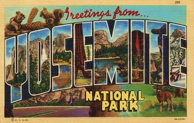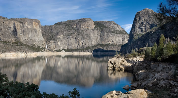
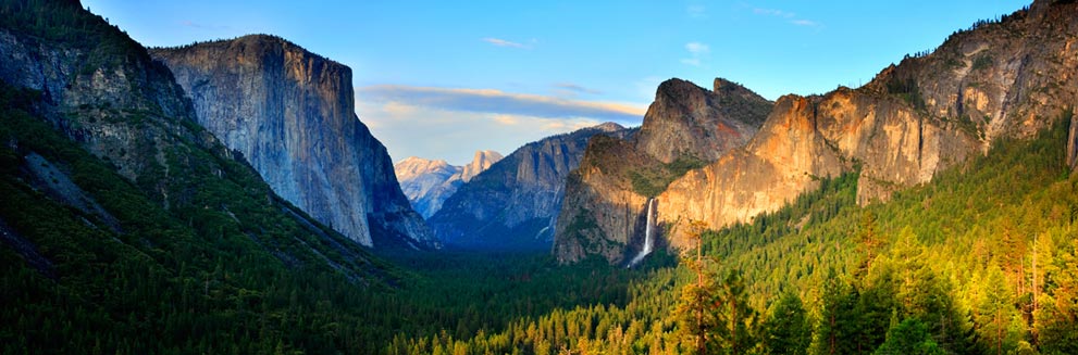
Yosemite National Park is located in the state of California on the western portion of the Sierra Nevada Mountains ranging in elevation from 2,127 to 13,114 feet. The park covers almost 1190 square miles but most of the 3.5 million annual visitors spend the majority of their time in the seven square miles of Yosemite Valley. Visitors to Yosemite National Park will see the majestic El Capitan and Half Dome granite formations and a several waterfalls, such as Yosemite Falls and Bridalveil Fall, the beautiful open space of Tuolumne Meadows and the massive giant sequoia trees of the Mariposa Grove.
In Part One, of the two part series on Yosemite National Park, I discussed the history of the park throughout the years, please click on the link to Yosemite National Park (Part One). In Part Two, I will discuss Yosemite visitor information and give a list of suggested places to see and things to see and do.
Yosemite National Park Visitor Information
Tips and suggestions for planning a visit to the park
- I always recommend when visiting any of our National Parks, it is a good idea to start at the Visitor Center where visitors can get maps, brochures, hiking permits and current weather information or road closures. Also be sure to check the schedule of Ranger presentations or guided hikes which are a great source of information about the park.

- For general information on Yosemite National Park please click on the link to their website www.nps.gov/yose for the most accurate information regarding Visitor Center hours, wilderness permits, road closures or other park restrictions.
- Once you have determined the time of year you will be visiting the park, be sure to make reservations as far in advance as possible especially during the summer months, Memorial Day to Labor Day. (Please click on the individual hotel and cabin accommodations website links mentioned in this post for more specific information regarding prices and availability)
- Yosemite National Park has several campgrounds and reservations are required from March through November. Campground reservations can be made up to five months in advance, on the 15th of each month at 7 am Pacific time. Be aware that nearly all reservations for the months of May through September are filled the first day they become available. Click on the link www.recreation.gov for more complete information.
- When visiting Yosemite Valley consider parking the car at your hotel, cabin or campground and take the readily available Yosemite shuttle buses which stop at all the major sites in the Valley.
- Bikes are another great alternative driving your car and an excellent way to avoid traffic congestion in the Valley especially during the summer months. You can bring your own bikes or rentals are also available, there are 12 miles of paved trails in the Valley, be sure to bring bike locks. Please be advised that mountain biking off the trails is not allowed.
- Rock Climbing has become an important part of the history of Yosemite; El Capitan is one of the most challenging mountains in the world. Various companies in the Valley offer a variety of classes from novice to experienced climbers. (For more information about El Capitan can be found later in this post)
- There are over 800 miles of hiking trails in Yosemite National Park ranging from easy trails that take under an hour, medium trails that can take a couple of hours and strenuous trails that can be a multiple day backpack adventure such as the John Muir Trail (which require a wilderness permit). Be prepared and check out the trails in advance, information is available at any of the park’s visitor centers. (obviously multi-day backpack trips are for the more experienced hikers and will take much more preparation, such as obtaining bear-resistant food storage containers.)
- When hiking stay on established trails, observe posted warning signs, carry water to stay hydrated and bring along snacks, stop occasionally and rest in the shade; and eat salty snacks.
Places to see in Yosemite National Park
Wawona Tunnel View –
Most visitors that come to Yosemite National Park arrive in Yosemite Valley through the Wawona Tunnel via California Highway 140 (El Portal Road). The Wawona Tunnel built through solid granite was completed in 1933 is 4,233 feet long making it the longest tunnel in California. After passing through the tunnel, visitors should stop at the Tunnel View Overlook for a wonderful view of Yosemite Valley. As you look out into the Valley from the overlook El Capitan is to the left, to the right is Bridalveil Fall and at the far end of the Valley is Half Dome.
Yosemite Valley –
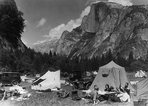
Yosemite Valley is the destination for most visitors coming to Yosemite National Park, it is open year-round. The numerous activities in the Valley include hiking the various trails, rafting down the Merced River, biking, horseback riding, rock climbing and ranger-led nature walks.
El Capitan –
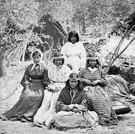
El Capitan is the granite monolith (a large single vertical rock formation) located at the north-west end of Yosemite Valley; it is 3,000 feet from base to summit. The Ahwanhneechee Native Americans called it “Totokonoolah” and the Mariposa Battalion translated the name into El Capitan. (Historic Fact: The Mariposa Battalion came to the area in 1851 and they were given the ominous task of removing the Native Americans from Yosemite Valley)
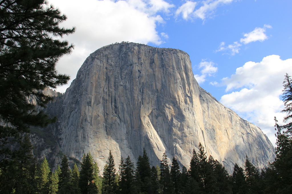
El Capitan is a popular destination for rock climbers, there is also a trail located near Yosemite Falls that can be used to reach the summit. El Capitan was once considered impossible to climb until 1958 when a trio of climbers named Warren Harding, Wayne Merry and George Whitmore reached the summit of an area known as “The Nose” in 47 days using rope, pitons and expansion bolts. Throughout the years other routes on the face of El Capitan were created and also new techniques and equipment were developed to make the ascent times faster.
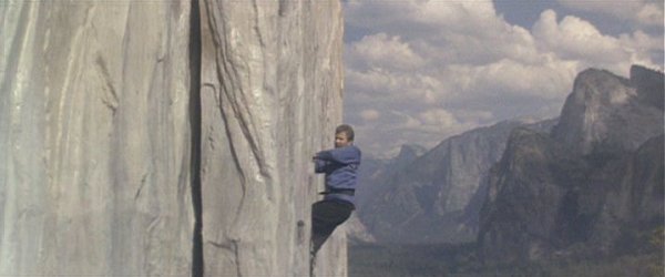
Yosemite National Park Trivia: El Capitan was used as the filming location for the 1989 “Star Trek – the Final Frontier” movie. The scene shows Captain Kirk, played by William Shatner, on shore leave from the Starship Enterprise scaling the face of El Capitan, he loses his grip on the mountain and starts to plummet to the ground but is saved by Spock, played by Leonard Nimoy. Shatner trained for several weeks on the Paramount lot for the close-up shots and stunt doubles for the long shots. For the scene of Spock floating in the air in his levitation boots as he talks to Captain Kirk, Nimoy stood on top of a crane.
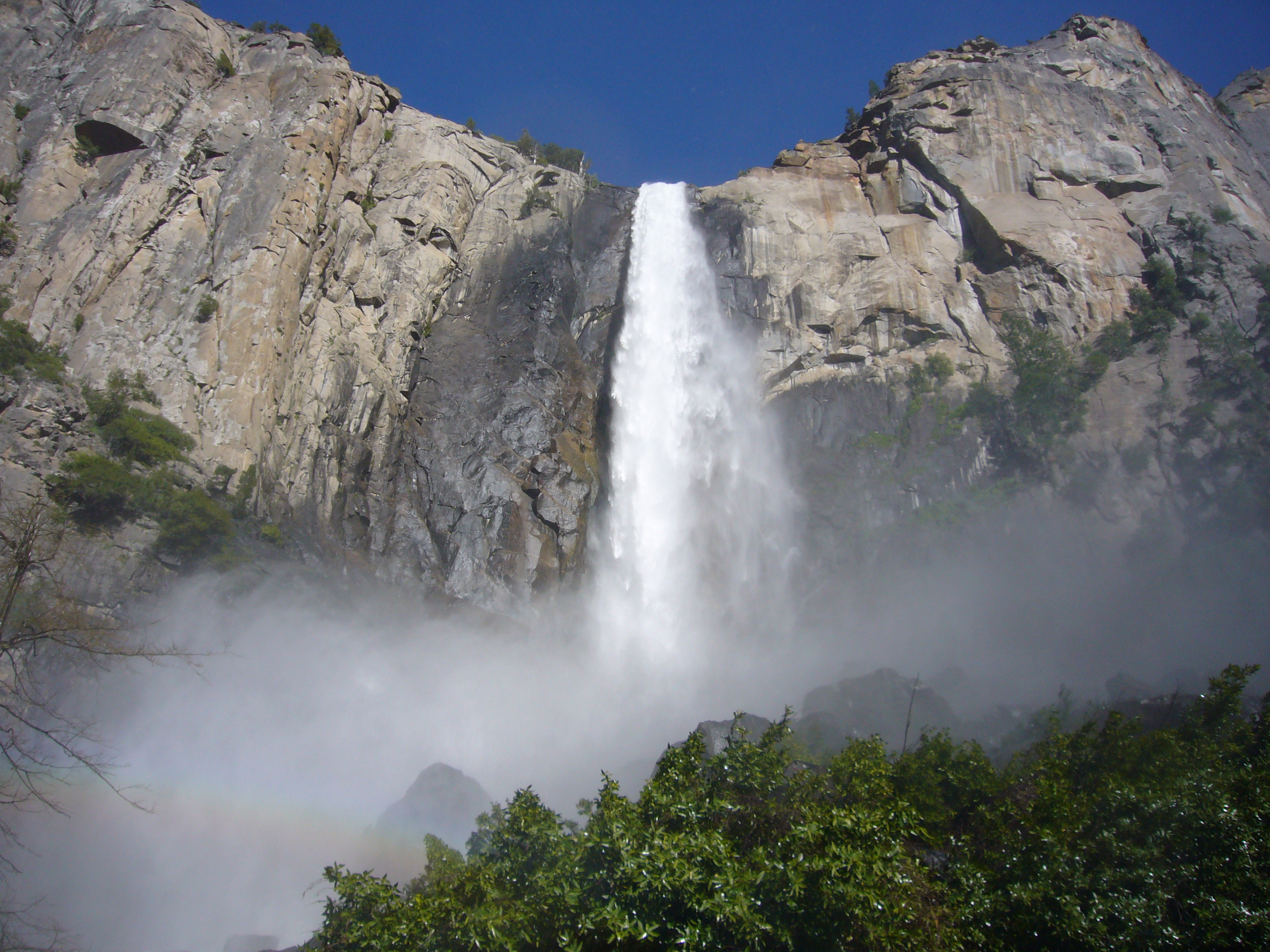
Bridalveil Fall –
Bridalveil Fall is the first waterfall visitors will see upon entering Yosemite Valley, it is located in the south-west area of the Valley. Bridalveil Fall is 620 feet in height and in the spring the fall usually runs very full but later in the year it slows to a small trickle. From the parking lot, there is a paved trail to reach the base of the fall and the viewing platform; use caution when reaching the base, the paved trail can be very wet and slippery. HAZARD WARNING: DO NOT LEAVE THE TRAIL TO CLIMB THE ROCKS AT THE BASE OF THE WATERFALL!!
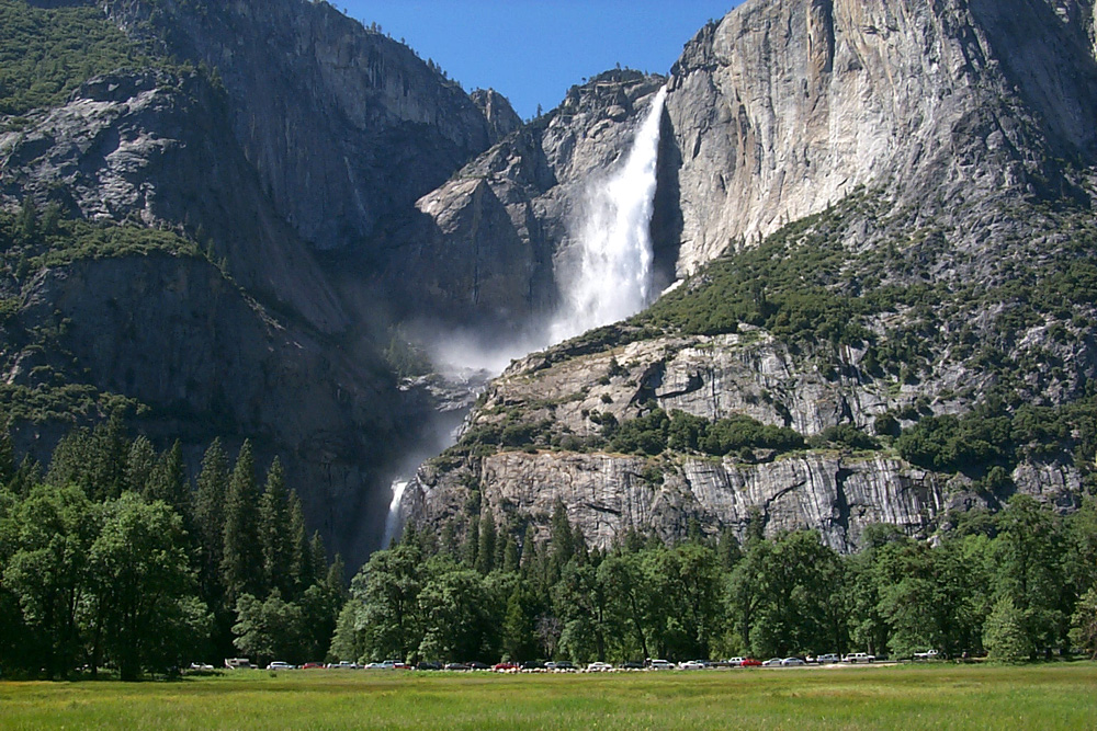
Yosemite Falls –
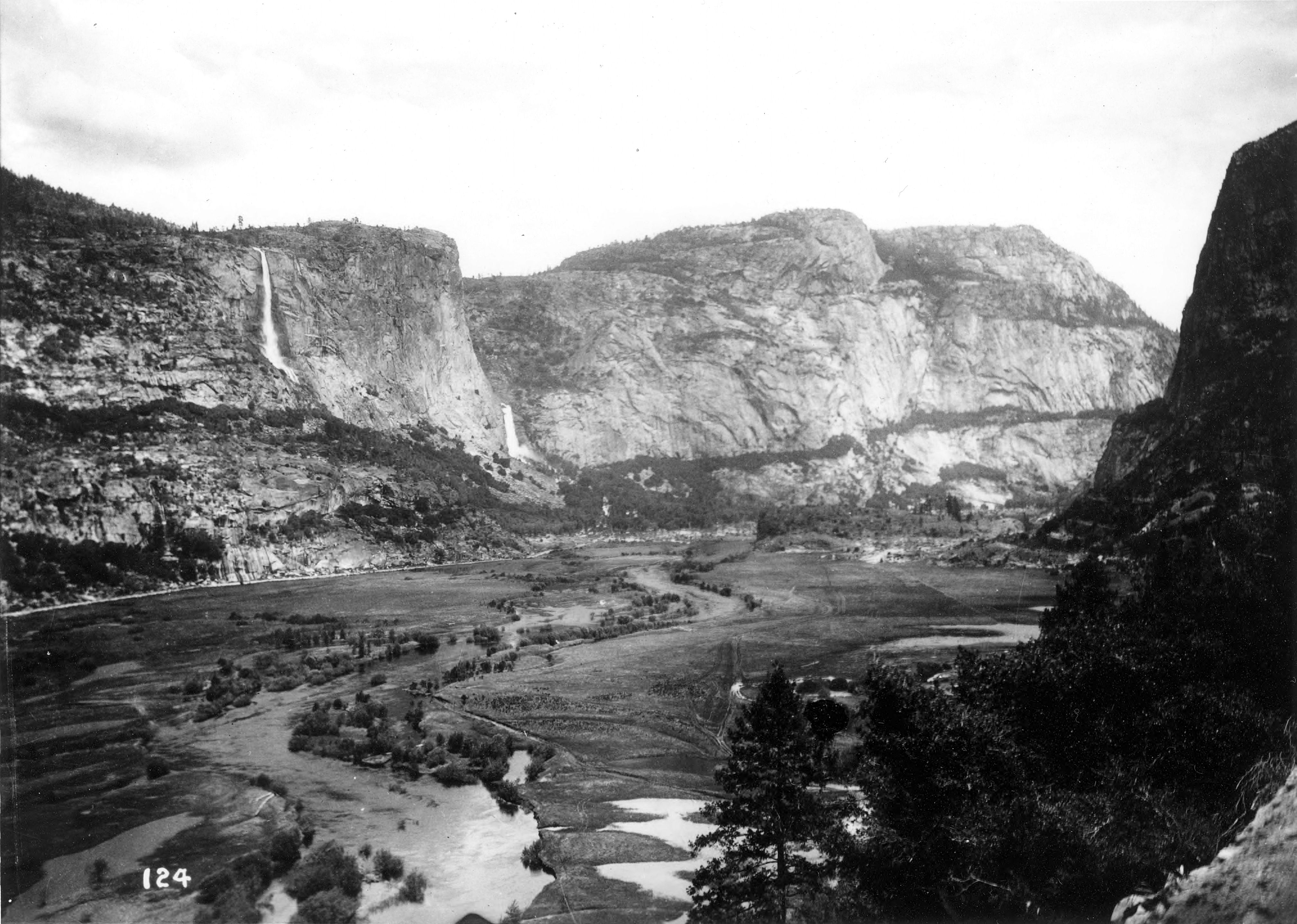
Yosemite Falls is located at a point midway through the Yosemite Valley on the north-side; the total length is 2,425 feet from the top of the upper fall to the base of the lower fall. The waterfall plunges from Yosemite Creek to the floor of the valley; the Upper Yosemite Fall is 1,430 feet, the Middle Cascades is a section with five separate plunges for a total of 675 feet and the Lower Yosemite Falls is 320 feet. The Yosemite Creek continues from the base of the waterfall and flows into the Merced River that runs through the length of the Valley. HAZARD WARNING: DO NOT LEAVE THE TRAIL TO CLIMB THE ROCKS AT THE BASE OF THE WATERFALL!!
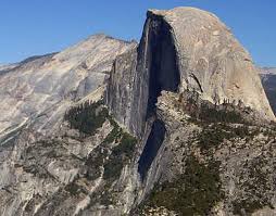
Half Dome –
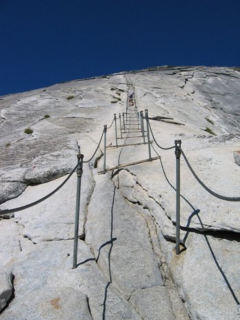
Half Dome is the granite dome located at the east end of Yosemite Valley, the summit rises 4,737 feet. Much like El Capitan at the other end of the Valley, Half Dome was thought to be impossible to climb. In 1875, George Anderson was able to climb to the summit by constructing a path by drilling and then placing iron bolts into the granite “back” or east side. Today, visitors hike the 8.2 mile Mist Trail, past Vernal and Nevada Falls, to reach the base of Half Dome. Then visitors climb the rounded east side via a set of steel cables to reach the summit, the cables are fixed with bolts on a series of metal poles leading from the base to the summit and are installed from late May to early October. Permits need to be arranged in advance before entering the park, a ranger will check permits on the trail and hikers without the proper permit will not be allowed beyond the base. Hikers caught bypassing the rangers will fined or receive possible jail time.
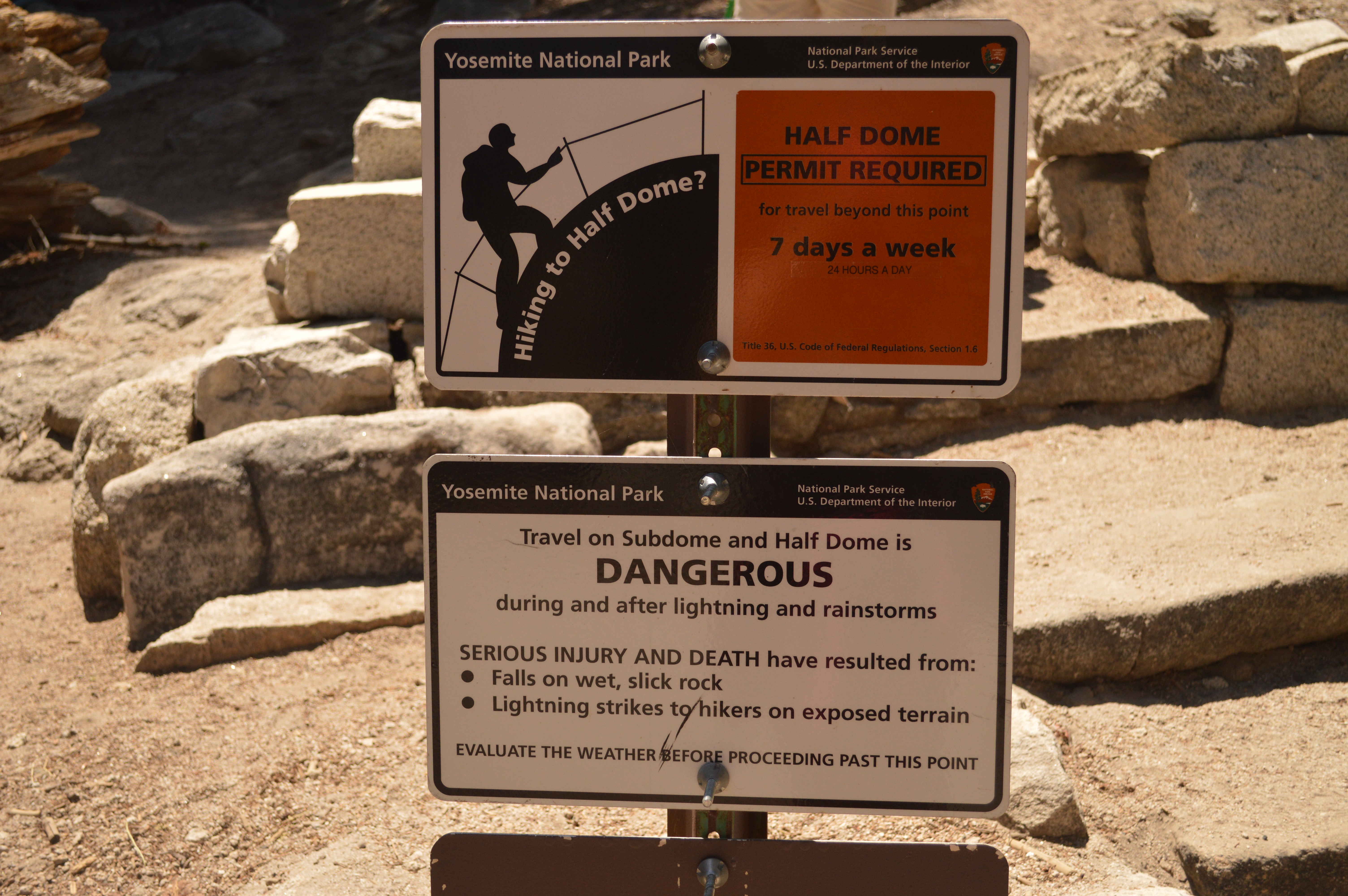
PLEASE BE ADVISED: THE NATIONAL PARK SERVICE RECOMMENDS AGAINST CLIMBING THE HALF DOME ROUTE WHEN THE CABLES ARE DOWN OR DURING BAD WEATHER CONDITIONS OR WHEN LIGHTNING STRIKES ARE OCCURRING IN THE VICINITY.
Native American Legend: The Ahwahneechee Native Americans called Half Dome by another name, “Tis-sa-ack”. The legend goes that Tissaack, a Native American woman and her husband Nangas lived far away from Yosemite on the Great Plains of America. The couple traveled to Yosemite over the rugged terrain of the Sierra Mountains until finally arriving a few days later in Yosemite Valley. But when they arrived, Nangas was feeling thirsty, hungry and short tempered, and he unexpectedly struck Tissaack and she became frightened and ran eastward back through the Valley to get away from him. The gods were looking down on the couple that was disturbing the peace of the Valley and intended for them to stop; as a result the gods changed Nangas into the rock formation known today as Washington Column and Tissaack into Half Dome. It is said the dark streaks on the face of Half Dome are the tears of Tissaack but they are in fact patches of brown lichens that has formed in the dark vertical grooves of the rock formation.

Vernal Fall / Nevada Fall –
The Mist Trail which travels along a path that takes visitors past two waterfalls, Vernal and Nevada Falls. The trail can sometimes be a strenuous climb to the top and sections of the trail can be closes during late fall and winter depending on snow and icy conditions. The first section of the trail starts at the Happy Isle parking lot and is paved to the Vernal Fall footbridge. The trail can get very crowded in the summer months, keep to the right climbing up and the left climbing down. From the footbridge visitors will have a good view of Vernal Fall, then proceed up a steep 600 step granite stairway, but be careful because the pathway can be wet and slippery from the spray of the waterfall. At the top of Vernal Fall, visitors can look straight down the length of the 317 foot waterfall.
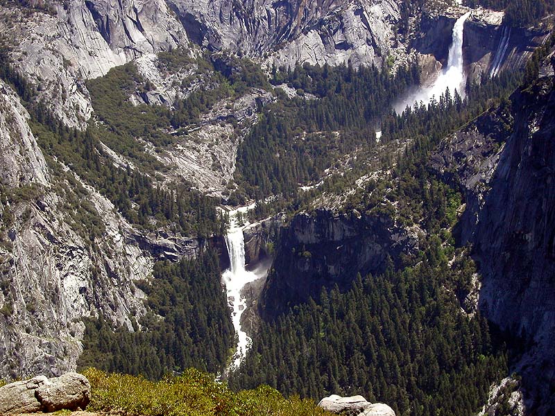
Just past Vernal Fall is Emerald Pool, please keep in mind that it is dangerous to swim in the pool due to the extremely hazardous current as the water moves down from Nevada Fall and continues down to Vernal Fall. As the Mist Trail continues the steep and rocky switchbacks that climb another 1.5 miles up to Nevada Fall. There is a footbridge at the top that crosses Nevada Fall as it thunders down 594 feet. There are several options that can be accessed from this part of the trail. Visitors can return down the same route in which they climb up (2.5 miles) or they can join the John Muir Trail for an alternate route back to Yosemite Valley (4 miles).
DANGEROUS CONDITIONS CAN EXIST WITH WET AND SLIPPERY AREAS ALONG THE MIST TRAIL. PLEASE OBSERVE ALL WARNING SIGNS AND DO NOT CROSS OVER RAILINGS OR ENTER THE WATER, THE CURRENT CAN BE VERY STRONG AND EXTREMELY DANGEROUS.
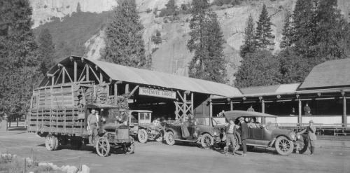
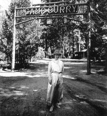
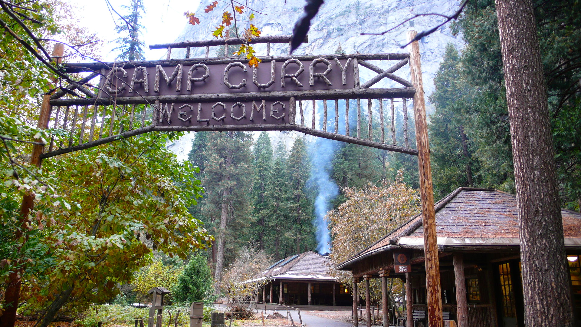
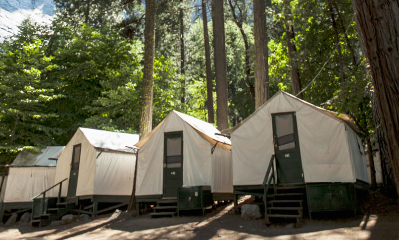
Curry Village –
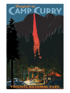
Curry Village has a very long history in the Yosemite Valley; it was originally founded in 1899 by David and Jennie Curry. When the couple, who were two schoolteachers from Indiana, decided to visit the park they found that they could barely afford the transportation and the park lodgings. So, as a result of their dilemma they established Camp Curry in 1899 which started as several canvas tents and a communal dining room for their guests. Not only was Camp Curry the most affordable accommodation within the Yosemite Valley but the Curry’s thought that entertainment was also a key to their success. So, throughout the years Camp Curry has featured a dance hall, nightly movies, a soda fountain, a swimming pool during the spring and summer months and an ice skating rink in the winter but the most famous nightly entertainment was the Yosemite FireFall. The dozen tents expanded into over a hundred and additional wooden cabins were also built and later the dance hall was converted into the Stoneman House lodge with 18 rooms. For more information about the Camp Curry facility and activities or to book a reservation for a stay in Yosemite Valley, please click on the link to their website at www.yosemitepark.com/curry-village.aspx
Historical Note: The Yosemite Firefall was a nightly summer time event that began in 1872 and for almost one hundred years, interrupted only during the World War II, until the event continued until 1968. From the top of Glacier Point in Yosemite National Park, the owner of the Glacier Point Hotel would start the event on the signal “Let the fire fall” from David Curry, the owner of Curry Village that was located 3,000 below in Yosemite Valley. Hot embers from a huge bonfire at Glacier Point would be pushed off the edge giving the appearance of a glowing waterfall in the night as the “Indian Love Call” song was played creating a very dramatic mood; the spectacle would conclude the evening program at Camp Curry. In the mid-1960s, the National Park Service was in the midst of changing their policy to eliminate unnatural activities from the parks and the order was given to stop the nightly Yosemite Firefall. Not only was it a potentially dangerous activity but the surrounding meadows near Camp Curry would be trampled every night with visitors gathering to catch a glimpse of the event. A year after the last Firefall in January 1968, the Glacier Point Hotel was standing vacant due to sustained damage from an unusually heavy snowfall that winter and an electrical fire in July 1969 burned down the hotel and it was never rebuilt.
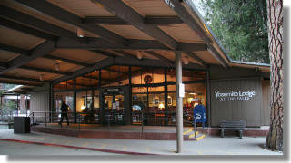
Yosemite Lodge at the Falls –
Formerly known as the Yosemite Lodge, the name was changed in the mid 2000s to reflect the hotel’s close proximity to Yosemite Falls located just 0.5 miles away. “The Lodge” is a moderately priced hotel with a total of 249 rooms spread out across the property in 15 separate buildings which are named after various flowers and trees that can be found in Yosemite National Park. The hotel was once a larger complex but the devastating flood of the Merced River in January 1997 destroyed over half of the pre-existing rooms and cabins. (Travel Tip: Book hotel reservations as far in advance as possible especially if a visit is planned during the busy summer months) To book a room at the Yosemite Lodge at the Falls, please click on the link to their website at www.yosemitepark.com/yosemite-lodge.aspx
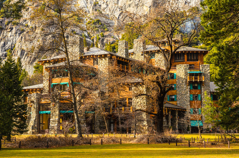
Ahwanhee Hotel –
The Ahwanhee Hotel is the premiere grand hotel in Yosemite National Park; it is the highest priced accommodations in the park with 123 beautifully decorated rooms in the hotel and 24 luxury cabins. To book a room at the Ahwanhee, please click on the link to their website at www.yosemitepark.com/ahwahnee-accommodations.aspx. (For more information regarding the history of the Ahwanhee Hotel and the annual Bracebridge which is held at the hotel every Christmas season since 1927, please click on the link)
Tuolumne Grove –
Tuolumne Grove is a small group of sequoia trees(Sequoiadendron giganteum) located near Crane Flat on Tioga Road (CA HWY 120) in Yosemite National Park, about 16 miles west of the Yosemite Valley. Although its location is closer to the Valley than Mariposa Grove in the southern part of the park, the Tuolumne Grove is definitely less crowded for a more quiet experience for visitors.
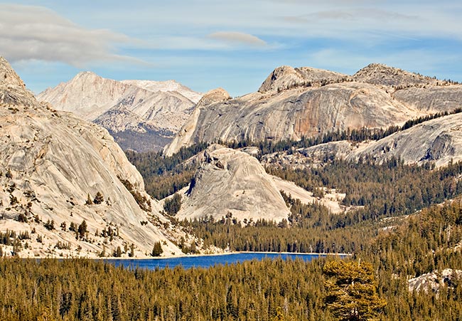
Tenaya Lake –
Tenaya Lake is an alpine lake in north-east part of Yosemite National Park and it is about 50 miles from Yosemite Valley; travel time on the mountainous Tioga Road can take almost an hour and a half. Tenaya Lake is at an elevation of elevation of 8,150 feet and was initially formed many centuries ago by ancient glaciers moving through the region. History notes that the lake was named for Chief Tenaya, the leader of the Ahwanhneechee Native Americans and it is on the shores of the lake that he met the Mariposa Brigade.
Tuolumne Meadows –
Tuolumne Meadows in located in the north-east part of Yosemite National Park and it is about 54 miles from Yosemite Valley; travel time on Tioga Road is about an hour and a half. Tuolumne Meadow is a large alpine meadow which located at an elevation of 8,619 feet and is surrounded by the Cathedral Range to the north and Lembert Dome to the north. In the winter the snowmelt sometimes floods the meadow turning the area into a temporary lake and in the late spring this brings a profusion of wildflowers with the Tuolumne River winding through the meadow.
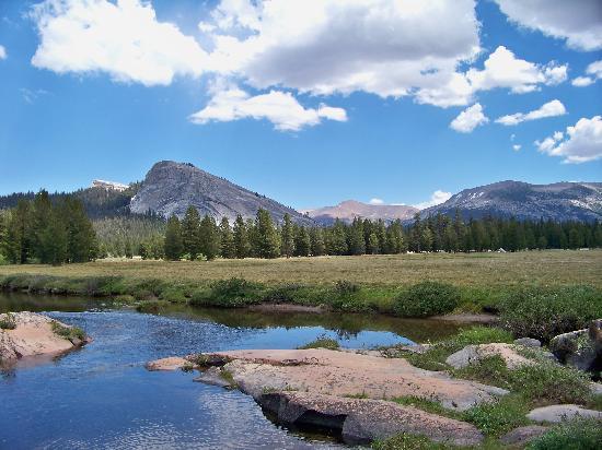
Tuolumne Meadows offers visitors an alternative to the sometimes crowded Yosemite Valley during the months from May to October with numerous opportunities for easy day hikes and rock climbing. In the winter Tuolumne Meadows and Tioga Road can be closed in the winter due to snow. Travel Advisory: For visitors traveling in late fall and winter should check in advance for road closures.
Tioga Pass –
Tioga Pass is located in the north-east part of Yosemite National Park; it is the highest California State Highway (120) that passes through the Sierra Nevada Mountains at an elevation of 9,943 feet. The Tioga Pass entrance to the park is subject to closures in late fall to winter due to heavy snowfall, visitors should check in advance if traveling in the area.

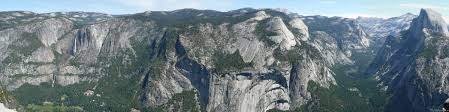
Glacier Point –
Glacier Point is located in the south-central part of Yosemite National Park with an elevation of 7,214 feet, it is 30 miles from Yosemite Valley and a one hour drive. From Glacier Point visitors are able to look down into Yosemite Valley, it is approximately 3,200 feet below to the Valley floor. Curry Village can be seen directly below and there are spectacular views of Yosemite Fall and El Capitan to the left with Half Dome, Vernal Fall and Nevada Fall to the right. Glacier Point can be reached by car or bus and the road is usually open from June to October. Visitors can also climb the Four Mile Trail from the Yosemite Valley up to Glacier Point, the trail is considered strenuous. In the winter the Glacier Point Road is closed and the Four Mile Trail can be extremely hazardous when covered with snow and ice.

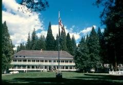
Wawona Hotel –
The Wawona Hotel is located in the southern part of Yosemite National Park; it is about 26 miles from Yosemite Valley and an hour and fifteen minute drive. The Wawona Hotel is also located 4 miles from the southern entrance to Yosemite National Park that is accessed via California State Highway 41 from Fresno. The Wawona Hotel was built in 1876 in a Victorian style with a veranda wrapping around the first and second floors. The hotel was originally built to accommodate visitors to the Mariposa Grove and later an addition was built in 1916 as tourism increased. The hotel has 104 guest rooms which have no telephones or televisions, what a novel idea! To book a room at the Yosemite Lodge at the Falls, please click on the link to their website at http://www.yosemitepark.com/wawona-hotel.aspx
Within walking distance to the Wawona Hotel are several trails that are used in the spring to fall seasons, cross-country skiing and snowshoe paths are available in the winter. Located across the highway from the hotel is a golf course which has been operating since 1918, it is one of the few golf courses within any National Park. The golf course is open from spring to fall.
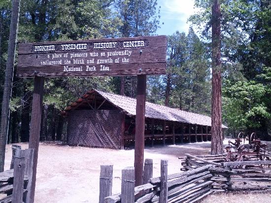
Pioneer Yosemite History Center –
The Pioneer Yosemite History Center is located a short distance from the Wawona Hotel. The Center is a collection of several historic buildings that were move there from previous locations in Yosemite National Park, such as the Wawona Covered Bridge and the Hodgdon Homestead Cabin. The Center is a wonderful place for visitors to explore and the buildings are usually open Wednesday to Sunday during the summer, it is an outdoor museum with interpretive signs and a self-guide brochures. Also in the summer there are living history demonstrations and stagecoach rides on the weekends.
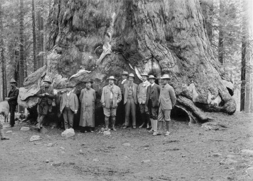
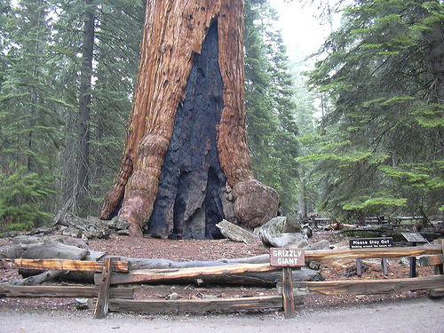
Mariposa Grove –
Mariposa Grove is a group of several giant sequoia trees (Sequoiadendron giganteum) located near the south entrance to Yosemite National Park, almost 30 miles from Yosemite Valley. Both the Mariposa Grove and Yosemite Valley were first protected by the Yosemite Grant, which was signed by President Abraham Lincoln in June 1864.
Here is a list of some of the sequoia trees found in the Mariposa Grove:
- The Grizzly Giant – The Grizzly Giant tree is the oldest tree in the Mariposa grove, it is between 1900-2400 years old. The Grizzly Giant is 210 feet tall with a diameter of 30 feet at the base.
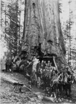
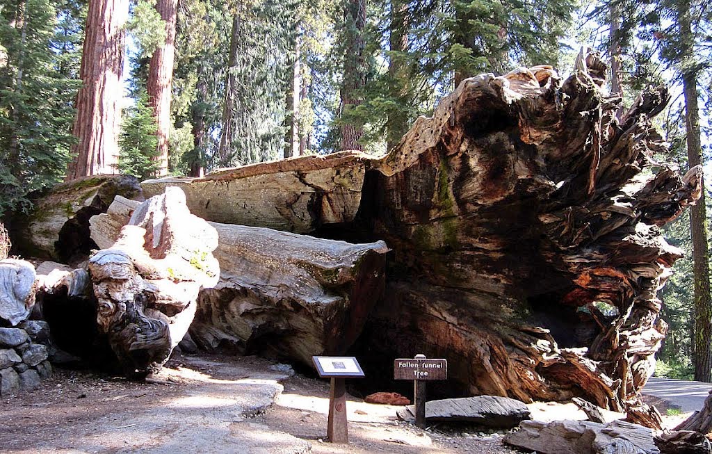
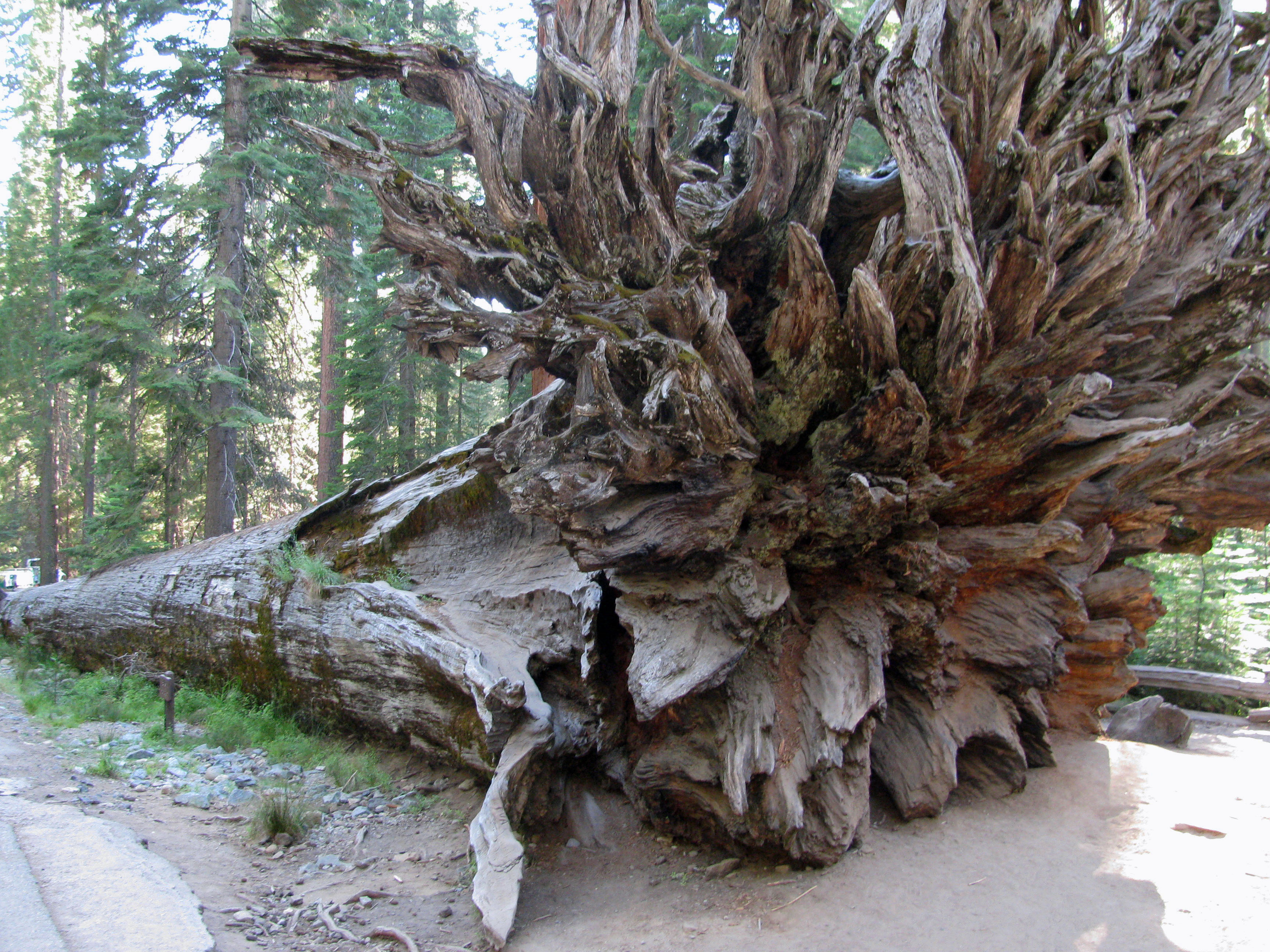
- The Wawona Tunnel Tree – The 227 feet tall Wawona Tunnel Tree was the first tree in the Mariposa grove to have a tunnel carved through its trunk in 1881, unfortunately the tree fell over during a snowstorm in 1969. This eventually led to the resurgence in the National Park Service preservation program and also a greater awareness and need for public education as to the sensitivity of ecosystems. As shown in the photos below, the tree was a major tourist attraction in the earliest days of the park and it was considered a novelty for visitors to ride through the tunnel in carriages and later automobiles.
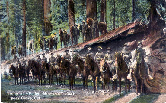
- The Fallen Monarch – The Fallen Monarch fell to the ground more than three hundred years ago and it serves as an example of how a giant sequoia is resistant to decay and can survive in a “preserved state” for a very long period of time when undisturbed.
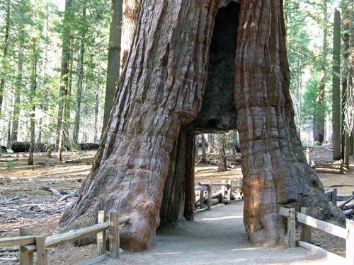
- The California Tunnel Tree – The California Tunnel Tree had a tunnel carved through its trunk in 1895, it is still standing in the Mariposa Grove and in the past visitors could ride a carriage or drive a car through but today visitors are only allowed to walk through it.
For more information about posts related to Yosemite National Park, please click on the links to:
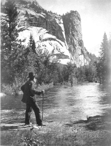
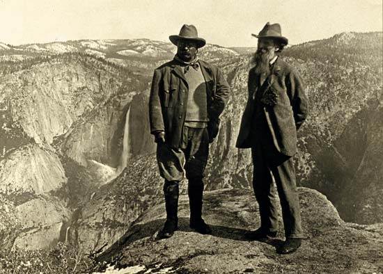
- John Muir post about the man that helped to establish Yosemite as a National Park as well as the first president of the Sierra Club,
- The Bracebridge Dinner post which is about the popular annual Christmas event held at the Ahwanhee Hotel in Yosemite and
- Sequoia National Park travel post with detailed information about one of the other nearby national parks in California.